|
search place name
|
||
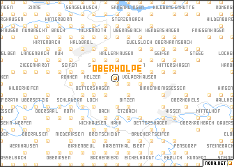
Oberholpe (Nordrhein-Westfalen, Germany)Oberholpe is a town in the Nordrhein-Westfalen region of Germany. An overview map of the region around Oberholpe is displayed below.
regional and 3d topo map of Oberholpe, Germany ::
Oberholpe airports ::
The nearest airport is CGN - Cologne Koln Bonn, located 37.1 km west of Oberholpe.
Other airports nearby include ZNV - Koblenz Winningen (57.3 km south), ZCA - Arnsberg Menden (74.1 km north), DTM - Dortmund (76.3 km north), DUS - Duesseldorf Dusseldorf (81.0 km north west), Nearby towns ::
Überholz (0.0km north) //
Holpe (0.0km north) //
Steimelhagen (1.2km east) //
Perseifen (1.2km west) //
Seifen (2.2km south east) //
Kohlberg (2.2km south west) //
Katzenbach (2.2km north east) //
Appenhagen (2.2km north east) //
Schnörringen (2.2km north west) //
Erblingen (2.2km north west) //
Volperhausen (2.3km east) //
Halscheid (3.7km south) //
Dellingen (3.7km south) //
Helzen (2.3km west) //
Berghausen (3.7km north) //
Wallerhausen (3.7km north) //
Rolshagen (3.7km north) //
Forst (3.9km south) //
Bitzen (3.9km south) //
Rhein (3.0km north east) //
Oettershagen (3.0km south west) //
Langenberg (3.0km south west) //
Bruchhausen (3.9km north) //
Heide (3.9km north) //
Lützingen (3.9km north) //
Loch (4.4km south west) //
Hurst (4.4km south west) //
Hahn (4.4km north east) //
Hufen (4.4km north west) //
[all distances 'as the bird flies' and approximate]  Places with similar names to Oberholpe, Germany :: Disclaimer :: Information on this page comes without warranty of any kind |
||
|
Where is Oberholpe? Elevation and coordinates ::
Latitude (lat): 50°50'0"N Longitude (lon): 7°40'0"E
Elevation (approx.): 230m (map arrows pan, magnifying glasses zoom) |
||
|
Visiting Oberholpe? Hotel/Accommodation ::
Book a hotel in Oberholpe Travel Guide ::
Buy a travel guide for Germany rental cars ::
car rental offers GPS waypoint ::
download a GPX waypoint (PoI) of Oberholpe for your GPS receiver
|
||