|
search place name
|
||
Obersinn (Bayern, Germany)Obersinn is a town in the Bayern region of Germany. An overview map of the region around Obersinn is displayed below.
regional and 3d topo map of Obersinn, Germany ::

Obersinn airports ::
The nearest airport is ZNF - Hanau Aaf, located 47.1 km west of Obersinn.
Other airports nearby include GHF - Giebelstadt Aaf (68.0 km south), FRA - Frankfurt Main (79.6 km west), MHG - Mannheim City (114.6 km south west), ERF - Erfurt (127.4 km north east), Nearby towns ::
Mittelsinn (1.9km south) //
Jossa (2.2km north west) //
Altengronau (3.7km north) //
Aspen Hütte (3.7km north) //
Emmerichsthal (3.6km west) //
Neuengronau (5.7km north) //
Aura im Sinngrund (5.1km south west) //
Roßbach (5.1km east) //
Zeitlofs (6.6km north east) //
Dietershof (7.8km north) //
Ziegelhütte (7.8km north) //
Burgsinn (7.8km south) //
Fellen (7.8km south) //
Barackenhöfe (7.3km north west) //
[all distances 'as the bird flies' and approximate] 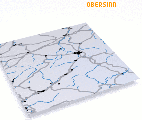 Places with similar names to Obersinn, Germany ::
// Obersayn (DE)
// Obórznia (PL)
// Obršine (BA)
// Obršine (BA)
// Obîrşeni (RO)
// Obîrşeni (RO)
// Oboroceni (RO)
// Oborozhnyy (UA)
// Obršani (MK)
// Oberreißen (DE)
Disclaimer :: Information on this page comes without warranty of any kind |
||
|
Where is Obersinn? Elevation and coordinates ::
Latitude (lat): 50°13'0"N Longitude (lon): 9°37'0"E
Elevation (approx.): 288m (map arrows pan, magnifying glasses zoom) |
||
|
Visiting Obersinn? Hotel/Accommodation ::
Book a hotel in Obersinn Travel Guide ::
Buy a travel guide for Germany rental cars ::
car rental offers GPS waypoint ::
download a GPX waypoint (PoI) of Obersinn for your GPS receiver
|
||