|
search place name
|
||
Ohlenrode (Niedersachsen, Germany)Ohlenrode is a town in the Niedersachsen region of Germany. An overview map of the region around Ohlenrode is displayed below.
regional and 3d topo map of Ohlenrode, Germany ::

Ohlenrode airports ::
The nearest airport is BWE - Braunschweig Wolfsburg, located 58.8 km north east of Ohlenrode.
Other airports nearby include HAJ - Hannover (64.3 km north), KSF - Kassel Calden (71.1 km south west), ZCN - Celle (75.1 km north), PAD - Paderborn Lippstadt (101.3 km west), Nearby towns ::
Wetteborn (1.1km west) //
Eyershausen (1.1km west) //
Dankelsheim (2.2km south east) //
Gehrenrode (2.9km north east) //
Clus (3.9km south) //
Heckenbeck (4.4km south west) //
Helmscherode (3.4km east) //
Westerberg (3.9km north west) //
Drei Linden (5.7km south) //
Graste (5.7km north) //
Lamspringe (5.7km north) //
Altgandersheim (3.9km south east) //
Orxhausen (6.0km south) //
Bad Gandersheim (6.0km south) //
Kreiensen (6.0km south) //
Hornsen (6.0km north) //
Bentierode (7.4km south) //
Schildhorst (4.6km west) //
Wöllersheim (7.5km north) //
Klump (4.9km west) //
Winzenburg (4.9km west) //
Rimmerode (7.5km south) //
Siedlung Leinetal (4.9km west) //
Gremsheim (4.9km east) //
Beulshausen (6.5km south west) //
Harbarnsen (7.8km north) //
Netze (7.8km north) //
Wolperode (5.9km south east) //
Erzhausen (5.9km south west) //
[all distances 'as the bird flies' and approximate] 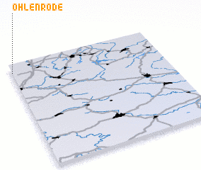 Places with similar names to Ohlenrode, Germany :: Disclaimer :: Information on this page comes without warranty of any kind |
||
|
Where is Ohlenrode? Elevation and coordinates ::
Latitude (lat): 51°55'0"N Longitude (lon): 10°0'0"E
Elevation (approx.): 181m (map arrows pan, magnifying glasses zoom) |
||
|
Visiting Ohlenrode? Hotel/Accommodation ::
Book a hotel in Ohlenrode Travel Guide ::
Buy a travel guide for Germany rental cars ::
car rental offers GPS waypoint ::
download a GPX waypoint (PoI) of Ohlenrode for your GPS receiver
|
||