|
search place name
|
||
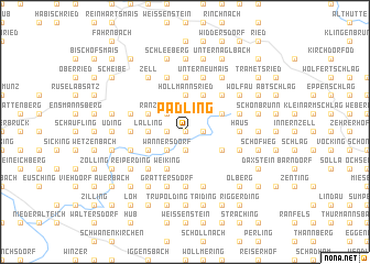
Padling (Bayern, Germany)Padling is a town in the Bayern region of Germany. An overview map of the region around Padling is displayed below.
regional and 3d topo map of Padling, Germany ::
Padling airports ::
The nearest airport is LNZ - Linz (Horsching), located 101.9 km south east of Padling.
Other airports nearby include MUC - Munich Munchen (115.8 km south west), SZG - Salzburg (118.1 km south), KLV - Karlovy Vary (151.6 km north), FEL - Fuerstenfeldbruck Furstenfeldbruck (157.5 km south west), Nearby towns ::
Rohrstetten (0.0km north) //
Sondorf (1.2km east) //
Hunding (1.2km east) //
Gneisting (1.2km east) //
Panholling (1.2km west) //
Züding (1.2km west) //
Reigersberg (1.9km south) //
Kieflitz (1.9km south) //
Euschertsfurth (2.2km south west) //
Wannersdorf (2.2km south west) //
Ranzingerberg (2.2km north west) //
Höllmannsried (3.7km north) //
Lalling (2.4km west) //
Ranzing (2.4km west) //
Gerholling (2.4km west) //
Hangenleithen (3.9km north) //
Oberlangfurth (3.1km south east) //
Unterlangfurth (3.1km south east) //
Allhartsmais (3.1km north east) //
Weiking (3.9km south) //
Lanzing (3.9km south) //
Eiserding (3.9km south) //
Nabin (3.9km south) //
Hinterherberg (3.1km south west) //
Gottsmannsdorf (3.1km south west) //
Durchfurth (3.1km north west) //
Raindorf (4.4km north east) //
Laiflitz (4.4km north east) //
Vorderherberg (4.4km south west) //
[all distances 'as the bird flies' and approximate] 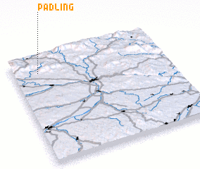 Places with similar names to Padling, Germany ::
// Pettling (DE)
// Pietling (DE)
// Petaling (MY)
// Podu lui Neag (RO)
// Podu lui Neag (RO)
// Podu Lung (RO)
// Patulang (ID)
// Petaling (ID)
// Petaling (ID)
// Petaling (ID)
Disclaimer :: Information on this page comes without warranty of any kind |
||
|
Where is Padling? Elevation and coordinates ::
Latitude (lat): 48°51'0"N Longitude (lon): 13°10'0"E
Elevation (approx.): 635m (map arrows pan, magnifying glasses zoom) |
||
|
Visiting Padling? Hotel/Accommodation ::
Book a hotel in Padling Travel Guide ::
Buy a travel guide for Germany rental cars ::
car rental offers GPS waypoint ::
download a GPX waypoint (PoI) of Padling for your GPS receiver
|
||