|
search place name
|
||
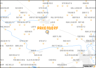
Pakendorf (Sachsen-Anhalt, Germany)Pakendorf is a town in the Sachsen-Anhalt region of Germany. An overview map of the region around Pakendorf is displayed below.
regional and 3d topo map of Pakendorf, Germany ::
Pakendorf airports ::
The nearest airport is LEJ - Leipzig Halle, located 54.8 km south of Pakendorf.
Other airports nearby include AOC - Altenburg Nobitz (107.8 km south), TXL - Berlin Tegel (108.2 km north east), THF - Berlin Tempelhof (108.5 km north east), SXF - Berlin Schonefeld (110.2 km north east), Nearby towns ::
Bias (1.9km north) //
Jütrichau (2.2km north east) //
Wertlau (2.9km south east) //
Luso (3.9km north) //
Akensche Vorstadt (3.9km north) //
Steutz (3.9km south) //
Leps (3.9km north west) //
Zerbst (5.7km north) //
Vorstadt Ankuhn (6.0km north) //
Bone (6.0km north) //
Rietzmeck (6.0km south) //
Pulspforde (6.0km north) //
Kermen (4.6km west) //
Vogelherd (7.5km north) //
Brambach (6.5km south east) //
Neeken (5.9km south east) //
Aken (8.2km south west) //
Töppel (8.7km north west) //
Bonitz (8.7km north east) //
Großkühnau (8.7km south east) //
[all distances 'as the bird flies' and approximate] 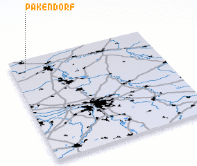 Places with similar names to Pakendorf, Germany ::
// Peukendorf (DE)
// Poggendorf (DE)
Disclaimer :: Information on this page comes without warranty of any kind |
||
|
Where is Pakendorf? Elevation and coordinates ::
Latitude (lat): 51°55'0"N Longitude (lon): 12°6'0"E
Elevation (approx.): 71m (map arrows pan, magnifying glasses zoom) |
||
|
Visiting Pakendorf? Hotel/Accommodation ::
Book a hotel in Pakendorf Travel Guide ::
Buy a travel guide for Germany rental cars ::
car rental offers GPS waypoint ::
download a GPX waypoint (PoI) of Pakendorf for your GPS receiver
|
||