|
search place name
|
||
Pamsendorf (Bayern, Germany)Pamsendorf is a town in the Bayern region of Germany. An overview map of the region around Pamsendorf is displayed below.
regional and 3d topo map of Pamsendorf, Germany ::

Pamsendorf airports ::
The nearest airport is BYU - Bayreuth, located 71.2 km north west of Pamsendorf.
Other airports nearby include NUE - Nuernberg Nurnberg (88.1 km west), KLV - Karlovy Vary (90.4 km north east), HOQ - Hof Plauen (93.0 km north), MUC - Munich Munchen (132.6 km south), Nearby towns ::
Hohentreswitz (1.2km west) //
Bernhof (1.2km east) //
Fuchsendorf (1.9km north) //
Trefnitz (1.9km south) //
Atzenhof (1.9km north) //
Trausnitz (2.2km north west) //
Oberpierlhof (2.2km north east) //
Bierlhof (2.2km north east) //
Trichenricht (2.2km south east) //
Rappenberg (2.4km west) //
Reisach (3.7km north) //
Weidenthal (3.7km south) //
Steinach (2.4km east) //
Oberaich (3.9km south) //
Tauchersdorf (3.0km south west) //
Kaufnitz (3.9km north) //
Lampenricht (3.0km north east) //
Mitteraich (4.4km south west) //
Köttlitz (4.4km north west) //
Pischdorf (4.4km south east) //
Guteneck (5.6km south) //
Gleiritsch (3.6km east) //
Löffelsberg (3.6km west) //
Weinrieth (5.7km north) //
Großenschwand (5.7km north) //
Oberkatzbach (5.7km south) //
Pilchau (4.1km north east) //
Wiesensüß (4.1km south west) //
Stein (4.1km north west) //
[all distances 'as the bird flies' and approximate] 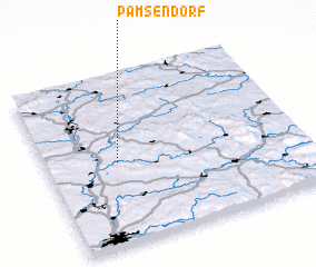 Places with similar names to Pamsendorf, Germany :: Disclaimer :: Information on this page comes without warranty of any kind |
||
|
Where is Pamsendorf? Elevation and coordinates ::
Latitude (lat): 49°30'0"N Longitude (lon): 12°17'0"E
Elevation (approx.): 480m (map arrows pan, magnifying glasses zoom) |
||
|
Visiting Pamsendorf? Hotel/Accommodation ::
Book a hotel in Pamsendorf Travel Guide ::
Buy a travel guide for Germany rental cars ::
car rental offers GPS waypoint ::
download a GPX waypoint (PoI) of Pamsendorf for your GPS receiver
|
||