|
search place name
|
||
Papenberg (Sachsen-Anhalt, Germany)Papenberg is a town in the Sachsen-Anhalt region of Germany. An overview map of the region around Papenberg is displayed below.
regional and 3d topo map of Papenberg, Germany ::

Papenberg airports ::
The nearest airport is BWE - Braunschweig Wolfsburg, located 56.5 km west of Papenberg.
Other airports nearby include ZCN - Celle (98.1 km west), LEJ - Leipzig Halle (113.2 km south east), HAJ - Hannover (117.0 km west), SZW - Schwerin Parchim (128.3 km north), Nearby towns ::
Detzel (1.9km north) //
Haldensleben III (2.2km south west) //
Satuelle (3.7km north) //
Haldensleben (2.3km east) //
Bülstringen (2.9km north west) //
Uthmöden (5.7km north) //
Hundisburg (5.7km south) //
Süplingen (3.9km south west) //
Althaldensleben (5.0km south east) //
Eiche (5.0km south west) //
Haldensleben II (6.0km south) //
Lübberitz (6.0km north) //
Bebertal Zwei (7.8km south) //
Ellersell (7.2km north west) //
Wieglitz (8.7km north west) //
Glüsig (8.7km south east) //
[all distances 'as the bird flies' and approximate] 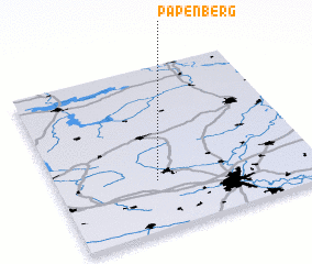 Places with similar names to Papenberg, Germany ::
// Pappenberg (DE)
// Papenberg (DE)
// Papenberg (DE)
// Papenbrook (DE)
// Papenburg (DE)
// Poppenberg (DE)
// Poppenberg (DE)
// Poppenberg (DE)
// Poppenberg (DE)
// Poppenbrügge (DE)
Disclaimer :: Information on this page comes without warranty of any kind |
||
|
Where is Papenberg? Elevation and coordinates ::
Latitude (lat): 52°18'0"N Longitude (lon): 11°23'0"E
Elevation (approx.): 54m (map arrows pan, magnifying glasses zoom) |
||
|
Visiting Papenberg? Hotel/Accommodation ::
Book a hotel in Papenberg Travel Guide ::
Buy a travel guide for Germany rental cars ::
car rental offers GPS waypoint ::
download a GPX waypoint (PoI) of Papenberg for your GPS receiver
|
||