|
search place name
|
||
Poing (Bayern, Germany)Poing is a town in the Bayern region of Germany. An overview map of the region around Poing is displayed below.
regional and 3d topo map of Poing, Germany ::

Poing airports ::
The nearest airport is MUC - Munich Munchen, located 20.9 km north of Poing.
Other airports nearby include OBF - Oberpfaffenhofen (40.8 km west), FEL - Fuerstenfeldbruck Furstenfeldbruck (41.1 km west), AGB - Augsburg (71.7 km north west), SZG - Salzburg (97.9 km south east), Nearby towns ::
Garkofen (0.0km north) //
Ottersberg (1.9km north) //
Angelbrechting (1.9km south) //
Neufarn (2.2km south east) //
Froschkern (2.2km south east) //
Lindach (2.5km east) //
Grub (2.5km west) //
Anzing (3.1km south east) //
Ziegelstadel (3.1km south east) //
Pliening (3.9km north) //
Gelting (3.9km north) //
Landsham (3.1km north west) //
Purfing (3.9km south) //
Frotzhofen (4.5km south east) //
Parsdorf (4.5km south west) //
Heimstetten (3.7km west) //
Finsing (5.7km north) //
Wolfesing (5.7km south) //
Neufinsing (5.7km north) //
Hergolding (5.7km south) //
Obelfing (4.1km south east) //
Weißenfeld (4.1km south west) //
Lausbach (6.1km north east) //
Vaterstetten (6.1km south west) //
Unterasbach (5.3km east) //
Oberasbach (5.3km east) //
Pöring (7.5km south) //
Ingelsberg (7.5km south) //
Kirchheim bei München (5.3km west) //
[all distances 'as the bird flies' and approximate] 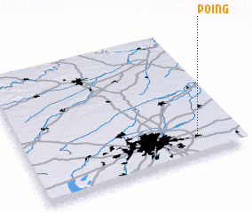 Places with similar names to Poing, Germany ::
Disclaimer :: Information on this page comes without warranty of any kind |
||
|
Where is Poing? Elevation and coordinates ::
Latitude (lat): 48°10'0"N Longitude (lon): 11°49'0"E
Elevation (approx.): 532m (map arrows pan, magnifying glasses zoom) |
||
|
Visiting Poing? Hotel/Accommodation ::
Book a hotel in Poing Travel Guide ::
Buy a travel guide for Germany rental cars ::
car rental offers GPS waypoint ::
download a GPX waypoint (PoI) of Poing for your GPS receiver
|
||