|
search place name
|
||
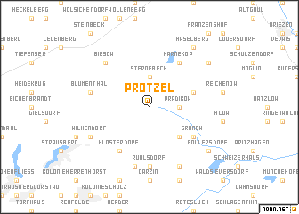
Prötzel (Brandenburg, Germany)Prötzel is a town in the Brandenburg region of Germany. An overview map of the region around Prötzel is displayed below.
regional and 3d topo map of Prötzel, Germany ::
Prötzel airports ::
The nearest airport is SXF - Berlin Schonefeld, located 42.1 km south west of Prötzel.
Other airports nearby include THF - Berlin Tempelhof (43.2 km south west), TXL - Berlin Tegel (47.8 km west), SZZ - Szczechin Goleniow (122.5 km north east), IEG - Zielona Gora Babimost (135.3 km south east), Nearby towns ::
Prädikow (2.2km east) //
Sternebeck (3.7km north) //
Ernsthof (4.3km south east) //
Herzhorn (3.8km north east) //
Klosterdorf (6.0km south) //
Grunow (5.0km south east) //
Harnekop (6.0km north) //
Ruhlsdorf (7.4km south) //
Hohenstein (7.5km south) //
Blumenthal (4.9km west) //
Biesow (6.5km north west) //
Wilkendorf (5.8km south west) //
Hasenholz (7.7km south) //
Bollersdorf (7.2km south east) //
Frankenfelde (7.2km north east) //
Haselberg (8.1km north east) //
[all distances 'as the bird flies' and approximate]  Places with similar names to Prötzel, Germany ::
// Porticella (IT)
// Porticello (IT)
// Praticello (IT)
// Portuzelo (PT)
// Portuzelo (PT)
// Portezuelo (ES)
// Portocelo (ES)
// Praducelo (ES)
// Portezuelo (CL)
// Portezuelo (CL)
Disclaimer :: Information on this page comes without warranty of any kind |
||
|
Where is Prötzel? Elevation and coordinates ::
Latitude (lat): 52°38'0"N Longitude (lon): 13°59'0"E
Elevation (approx.): 81m (map arrows pan, magnifying glasses zoom) |
||
|
Visiting Prötzel? Hotel/Accommodation ::
Book a hotel in Prötzel Travel Guide ::
Buy a travel guide for Germany rental cars ::
car rental offers GPS waypoint ::
download a GPX waypoint (PoI) of Prötzel for your GPS receiver
|
||