|
search place name
|
||
Rachelsberg (Bayern, Germany)Rachelsberg is a town in the Bayern region of Germany. An overview map of the region around Rachelsberg is displayed below.
regional and 3d topo map of Rachelsberg, Germany ::

Rachelsberg airports ::
The nearest airport is MUC - Munich Munchen, located 55.2 km north west of Rachelsberg.
Other airports nearby include SZG - Salzburg (61.4 km east), OBF - Oberpfaffenhofen (71.2 km west), FEL - Fuerstenfeldbruck Furstenfeldbruck (76.3 km west), INN - Innsbruck (100.9 km south west), Nearby towns ::
Unterthal (0.0km north) //
Pirach (0.0km north) //
Viehhausen (0.0km north) //
Könparn (0.0km north) //
Oberthal (1.2km east) //
Egg (1.2km east) //
Oberwindering (1.9km north) //
Unterwindering (1.9km north) //
Berg (1.9km south) //
Aschau (1.9km south) //
Straß (1.9km south) //
Wilperting (1.9km south) //
Hayng (1.9km south) //
Lungham (2.2km north east) //
Söchtenau (2.2km south east) //
Haid (2.2km south east) //
Viehhausen (2.2km north west) //
Benning (2.2km south west) //
Straßkirchen (2.2km south west) //
Reipersberg (2.2km south west) //
Hölking (2.2km south west) //
Weichselbaum (3.7km north) //
Lampersberg (3.7km south) //
Siferling (3.7km south) //
Vogtareuth (2.5km west) //
Winkl (2.5km west) //
Weiher (3.9km north) //
Au (3.9km north) //
Achen (3.9km north) //
[all distances 'as the bird flies' and approximate] 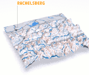 Places with similar names to Rachelsberg, Germany ::
// Rochollsberg (DE)
Disclaimer :: Information on this page comes without warranty of any kind |
||
|
Where is Rachelsberg? Elevation and coordinates ::
Latitude (lat): 47°57'0"N Longitude (lon): 12°13'0"E
Elevation (approx.): 470m (map arrows pan, magnifying glasses zoom) |
||
|
Visiting Rachelsberg? Hotel/Accommodation ::
Book a hotel in Rachelsberg Travel Guide ::
Buy a travel guide for Germany rental cars ::
car rental offers GPS waypoint ::
download a GPX waypoint (PoI) of Rachelsberg for your GPS receiver
|
||