|
search place name
|
||
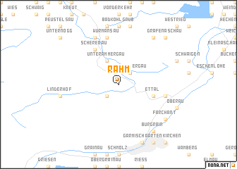
Rahm (Bayern, Germany)Rahm is a town in the Bayern region of Germany. An overview map of the region around Rahm is displayed below.
regional and 3d topo map of Rahm, Germany ::
Rahm airports ::
The nearest airport is INN - Innsbruck, located 42.2 km south east of Rahm.
Other airports nearby include OBF - Oberpfaffenhofen (58.1 km north), FEL - Fuerstenfeldbruck Furstenfeldbruck (71.1 km north), AGB - Augsburg (94.0 km north), MUC - Munich Munchen (101.8 km north east), Nearby towns ::
Graswang (2.2km south west) //
Oberammergau (2.2km north east) //
Unterammergau (3.9km north) //
Ettal (4.2km south east) //
Scherenau (6.1km north west) //
Untermberg (5.3km east) //
Sonnen (7.5km north) //
Kraggenau (7.5km north) //
Wurmansau (7.5km north) //
Altenau (7.8km north) //
Burgrain (8.3km south east) //
Mühldörfl (7.5km south east) //
Farchant (7.5km south east) //
Fuchsloch (8.3km north east) //
Aschau (8.9km north east) //
Grafenaschau (8.9km north east) //
[all distances 'as the bird flies' and approximate] 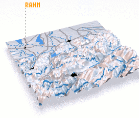 Places with similar names to Rahm, Germany ::
Disclaimer :: Information on this page comes without warranty of any kind |
||
|
Where is Rahm? Elevation and coordinates ::
Latitude (lat): 47°35'0"N Longitude (lon): 11°3'0"E
Elevation (approx.): 1375m (map arrows pan, magnifying glasses zoom) |
||
|
Visiting Rahm? Hotel/Accommodation ::
Book a hotel in Rahm Travel Guide ::
Buy a travel guide for Germany rental cars ::
car rental offers GPS waypoint ::
download a GPX waypoint (PoI) of Rahm for your GPS receiver
|
||