|
search place name
|
||
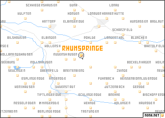
Rhumspringe (Niedersachsen, Germany)Rhumspringe is a town in the Niedersachsen region of Germany. An overview map of the region around Rhumspringe is displayed below.
regional and 3d topo map of Rhumspringe, Germany ::
Rhumspringe airports ::
The nearest airport is KSF - Kassel Calden, located 66.9 km west of Rhumspringe.
Other airports nearby include ERF - Erfurt (81.3 km south east), BWE - Braunschweig Wolfsburg (83.7 km north), HAJ - Hannover (106.4 km north west), ZCN - Celle (113.7 km north), Nearby towns ::
Lütgenhausen (1.2km west) //
Hilkerode (2.2km south east) //
Rüdershausen (2.3km west) //
Breitenberg (3.9km south) //
Pöhlde (3.9km north) //
Langenhagen (5.7km south) //
Wollershausen (3.9km north west) //
Haarbrück (5.1km north east) //
Brochthausen (5.0km east) //
Elbingerode (7.5km north) //
Fuhrbach (6.5km south east) //
Mingerode (6.5km south west) //
Duderstadt (7.8km south) //
Herzberg am Harz (7.8km north) //
Obernfeld (5.9km south west) //
Langenthal (5.9km north east) //
Elbingen (5.9km north west) //
Jützenbach (8.7km south east) //
Westerode (8.7km south west) //
Hattorf (8.7km north west) //
[all distances 'as the bird flies' and approximate] 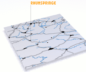 Places with similar names to Rhumspringe, Germany :: Disclaimer :: Information on this page comes without warranty of any kind |
||
|
Where is Rhumspringe? Elevation and coordinates ::
Latitude (lat): 51°35'0"N Longitude (lon): 10°18'0"E
Elevation (approx.): 174m (map arrows pan, magnifying glasses zoom) |
||
|
Visiting Rhumspringe? Hotel/Accommodation ::
Book a hotel in Rhumspringe Travel Guide ::
Buy a travel guide for Germany rental cars ::
car rental offers GPS waypoint ::
download a GPX waypoint (PoI) of Rhumspringe for your GPS receiver
|
||