|
search place name
|
||
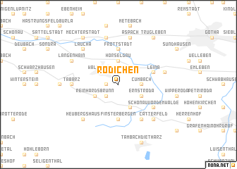
Rödichen (Thüringen, Germany)Rödichen is a town in the Thüringen region of Germany. An overview map of the region around Rödichen is displayed below.
regional and 3d topo map of Rödichen, Germany ::
Rödichen airports ::
The nearest airport is ERF - Erfurt, located 28.4 km east of Rödichen.
Other airports nearby include KSF - Kassel Calden (102.6 km north west), HOQ - Hof Plauen (111.7 km south east), BYU - Bayreuth (125.0 km south east), LEJ - Leipzig Halle (131.1 km north east), Nearby towns ::
Schnepfenthal (1.2km west) //
Friedrichroda (2.2km south west) //
Ibenhain (2.2km north west) //
Waltershausen (2.2km north west) //
Wahlwinkel (2.2km north east) //
Cumbach (2.3km east) //
Hörselgau (3.7km north) //
Reinhardsbrunn (3.0km south west) //
Engelsbach (3.9km south) //
Ernstroda (3.0km south east) //
Finsterbergen (5.6km south) //
Fröttstädt (5.6km north) //
Leina (4.0km north east) //
Schönau vor dem Walde (5.1km south east) //
Altenbergen (6.0km south east) //
Tabarz (4.7km west) //
Teutleben (7.5km north) //
Gospiteroda (5.0km east) //
Aspach (7.5km north) //
Heubergshaus (6.6km south west) //
Catterfeld (6.6km south east) //
Laucha (6.6km north west) //
Langenhain (6.0km north west) //
Mechterstädt (8.2km north west) //
Trügleben (8.2km north east) //
[all distances 'as the bird flies' and approximate] 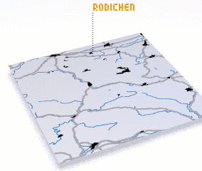 Places with similar names to Rödichen, Germany ::
Disclaimer :: Information on this page comes without warranty of any kind |
||
|
Where is Rödichen? Elevation and coordinates ::
Latitude (lat): 50°53'0"N Longitude (lon): 10°35'0"E
Elevation (approx.): 368m (map arrows pan, magnifying glasses zoom) |
||
|
Visiting Rödichen? Hotel/Accommodation ::
Book a hotel in Rödichen Travel Guide ::
Buy a travel guide for Germany rental cars ::
car rental offers GPS waypoint ::
download a GPX waypoint (PoI) of Rödichen for your GPS receiver
|
||