|
search place name
|
||
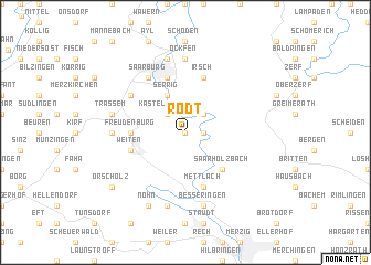
Rodt (Rheinland-Pfalz, Germany)Rodt is a town in the Rheinland-Pfalz region of Germany. An overview map of the region around Rodt is displayed below.
regional and 3d topo map of Rodt, Germany ::
Rodt airports ::
The nearest airport is LUX - Luxemburg Luxembourg, located 28.2 km west of Rodt.
Other airports nearby include ZQF - Trier Fohren (37.9 km north east), SPM - Spangdahlem Ab (47.7 km north), SCN - Saarbruecken Saarbrucken (53.4 km south east), MZM - Metz Frescaty (62.5 km south west), Nearby towns ::
Taben-Rodt (0.0km north) //
Taben (1.2km east) //
Staadt (2.2km north west) //
Kastel (2.2km north west) //
Kastel-Staadt (2.2km north west) //
Hamm (2.2km north east) //
Krutweiler (3.9km north) //
Serrig (3.9km north) //
Saarhölzbach (4.4km south east) //
Freudenburg (3.6km west) //
Beurig (5.7km north) //
Keuchingen (5.7km south) //
Mettlach (5.7km south) //
Weiten (4.1km south west) //
Irsch (5.7km north) //
Perdenbach (5.2km north west) //
Saarburg (6.1km north west) //
Kollesleuken (4.8km west) //
Ockfen (7.4km north) //
Trassem (5.2km west) //
Dreisbach (7.5km south) //
Niederleuken (7.5km north) //
Besseringen (7.5km south) //
Ponten (7.5km south) //
Nohn (7.8km south) //
Orscholz (7.4km south west) //
[all distances 'as the bird flies' and approximate] 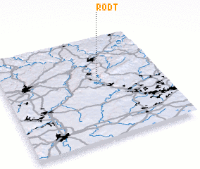 Places with similar names to Rodt, Germany ::
Disclaimer :: Information on this page comes without warranty of any kind |
||
|
Where is Rodt? Elevation and coordinates ::
Latitude (lat): 49°33'0"N Longitude (lon): 6°35'0"E
Elevation (approx.): 259m (map arrows pan, magnifying glasses zoom) |
||
|
Visiting Rodt? Hotel/Accommodation ::
Book a hotel in Rodt Travel Guide ::
Buy a travel guide for Germany rental cars ::
car rental offers GPS waypoint ::
download a GPX waypoint (PoI) of Rodt for your GPS receiver
|
||