|
search place name
|
||
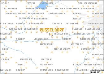
Rüsseldorf (Niedersachsen, Germany)Rüsseldorf is a town in the Niedersachsen region of Germany. An overview map of the region around Rüsseldorf is displayed below.
regional and 3d topo map of Rüsseldorf, Germany ::
Rüsseldorf airports ::
The nearest airport is WVN - Wilhelmshaven Mariensiel, located 45.1 km north of Rüsseldorf.
Other airports nearby include BRE - Bremen (49.7 km east), BRV - Bremerhaven (57.2 km north east), EME - Emden (63.8 km north west), NRD - Norderney (86.8 km north west), Nearby towns ::
Am Küstenkanal (0.0km north) //
Scharrelerdamm (1.1km east) //
Langendamm (1.9km south) //
Rudenbrook (2.2km north east) //
Hinterm Esch (2.2km north west) //
Jeddeloh Eins (2.2km north west) //
Klein Scharrel (2.2km east) //
Kleefeld (3.9km north) //
Jeddeloherdamm (2.9km north west) //
Jeddeloh Zwei (2.9km south west) //
Jeddeloherwiesen (3.9km south) //
Prinzendamm (3.9km south) //
Harbern Zwei (3.9km south) //
Ostland (5.6km south) //
Harbern (3.8km south east) //
Achternmeer (3.8km south east) //
Hogenset (3.8km south west) //
Janstrat (3.8km north west) //
Vor dem Moore (5.0km north west) //
Ekernermoor (6.0km north) //
Portsloge (5.0km north west) //
Saarländerweg (6.0km south) //
Kayhauserfeld (7.5km north) //
Korsorsberg (4.8km south east) //
Friedrichsfehn (4.8km north east) //
Süd Edewecht (4.8km north west) //
Benthullen (6.5km south east) //
Petersfehn (5.8km north east) //
Edewecht (5.8km north west) //
[all distances 'as the bird flies' and approximate] 
Disclaimer :: Information on this page comes without warranty of any kind |
||
|
Where is Rüsseldorf? Elevation and coordinates ::
Latitude (lat): 53°6'0"N Longitude (lon): 8°3'0"E
Elevation (approx.): 7m (map arrows pan, magnifying glasses zoom) |
||
|
Visiting Rüsseldorf? Hotel/Accommodation ::
Book a hotel in Rüsseldorf Travel Guide ::
Buy a travel guide for Germany rental cars ::
car rental offers GPS waypoint ::
download a GPX waypoint (PoI) of Rüsseldorf for your GPS receiver
|
||