|
search place name
|
||
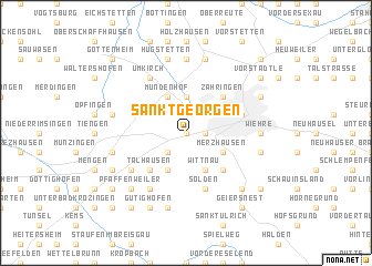
Sankt Georgen (Baden-Württemberg, Germany)Sankt Georgen is a town in the Baden-Württemberg region of Germany. An overview map of the region around Sankt Georgen is displayed below.
regional and 3d topo map of Sankt Georgen, Germany ::
Sankt Georgen airports ::
The nearest airport is CMR - Colmar Houssen, located 35.8 km north west of Sankt Georgen.
Other airports nearby include MLH - Bale Mulhouse (48.2 km south west), ZQL - Donaueschingen Villingen (53.9 km east), SXB - Strassbourg Entzheim (63.0 km north), ZRH - Zurich (80.5 km south east), Nearby towns ::
Steinwenden (0.0km north) //
Wendlingen (0.0km north) //
Uffhausen (0.0km north) //
Haslach (1.2km east) //
Leutersberg (2.2km south west) //
Lehen (3.7km north) //
Merzhausen (3.1km south east) //
Ebringen (3.9km south) //
Wittnau (3.9km south) //
Mundenhof (3.9km north) //
Talhausen (4.5km south west) //
Au (4.5km south east) //
Wolfenweiler (4.5km south west) //
Betzenhausen (4.5km north east) //
Zähringen (4.5km north east) //
Sölden (5.7km south) //
Biezighofen (5.7km south) //
Freiburg im Breisgau (4.2km north east) //
Schallstadt (5.3km south west) //
Öhlinsweiler (6.1km south west) //
Umkirch (6.1km north west) //
Hochdorf (7.4km north) //
Wiehre (5.0km east) //
Bollschweil (7.5km south) //
Föhrenschallstadt (5.3km west) //
Günterstal (5.3km east) //
Benzhausen (7.5km north) //
Hugstetten (7.5km north) //
Sankt Nikolaus (5.3km west) //
[all distances 'as the bird flies' and approximate] 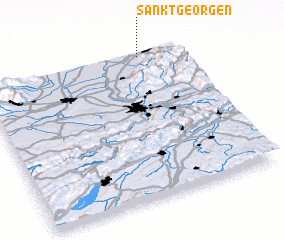 Places with similar names to Sankt Georgen, Germany ::
// Sankt Georgen (AT)
// Sankt Georgen (AT)
// Sankt Georgen (AT)
// Sankt Georgen (AT)
// Sankt Georgen (AT)
// Sankt Georgen (AT)
// Sankt Georgen (AT)
// Sankt Georgen (AT)
// Sankt Georgen (AT)
// Sankt Georgen (AT)
Disclaimer :: Information on this page comes without warranty of any kind |
||
|
Where is Sankt Georgen? Elevation and coordinates ::
Latitude (lat): 47°59'0"N Longitude (lon): 7°48'0"E
Elevation (approx.): 242m (map arrows pan, magnifying glasses zoom) |
||
|
Visiting Sankt Georgen? Hotel/Accommodation ::
Book a hotel in Sankt Georgen Travel Guide ::
Buy a travel guide for Germany rental cars ::
car rental offers GPS waypoint ::
download a GPX waypoint (PoI) of Sankt Georgen for your GPS receiver
|
||