|
search place name
|
||
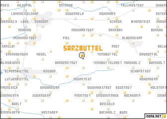
Sarzbüttel (Schleswig-Holstein, Germany)Sarzbüttel is a town in the Schleswig-Holstein region of Germany. An overview map of the region around Sarzbüttel is displayed below.
regional and 3d topo map of Sarzbüttel, Germany ::
Sarzbüttel airports ::
The nearest airport is KEL - Kiel Holtenau, located 69.2 km north east of Sarzbüttel.
Other airports nearby include HAM - Hamburg (75.7 km south east), XFW - Hamburg Finkenwerder (77.7 km south east), BRV - Bremerhaven (78.9 km south west), WVN - Wilhelmshaven Mariensiel (100.9 km south west), Nearby towns ::
Odderade (1.9km north) //
Dellbrück (1.9km south) //
Lehrsbüttel (2.1km north east) //
Bargenstedt (2.9km south west) //
Fiel (4.3km north west) //
Farnewinkel (4.3km south west) //
Nordhastedt (5.6km north) //
Tensbüttel (3.3km east) //
Krumstedt (5.6km south) //
Westerwohld (5.7km north) //
Tensbüttel-Röst (3.7km south east) //
Osterwohld (6.0km north) //
Epenwöhrdenermoor (4.7km north west) //
Röst (4.7km north east) //
Kleinhastedt (7.5km south) //
Nindorf (5.7km south west) //
Wolmersdorf (5.7km south west) //
Süderhastedt (7.7km south) //
Arkebek (7.1km north east) //
Schrum (8.6km north east) //
Windbergen (8.6km south west) //
[all distances 'as the bird flies' and approximate]  Places with similar names to Sarzbüttel, Germany :: Disclaimer :: Information on this page comes without warranty of any kind |
||
|
Where is Sarzbüttel? Elevation and coordinates ::
Latitude (lat): 54°7'0"N Longitude (lon): 9°11'0"E
Elevation (approx.): 6m (map arrows pan, magnifying glasses zoom) |
||
|
Visiting Sarzbüttel? Hotel/Accommodation ::
Book a hotel in Sarzbüttel Travel Guide ::
Buy a travel guide for Germany rental cars ::
car rental offers GPS waypoint ::
download a GPX waypoint (PoI) of Sarzbüttel for your GPS receiver
|
||