|
search place name
|
||
Schlöpitz (Thüringen, Germany)Schlöpitz is a town in the Thüringen region of Germany. An overview map of the region around Schlöpitz is displayed below.
regional and 3d topo map of Schlöpitz, Germany ::

Schlöpitz airports ::
The nearest airport is AOC - Altenburg Nobitz, located 8.8 km east of Schlöpitz.
Other airports nearby include LEJ - Leipzig Halle (52.8 km north), HOQ - Hof Plauen (84.2 km south west), KLV - Karlovy Vary (92.9 km south east), DRS - Dresden (98.8 km east), Nearby towns ::
Göhren (1.2km west) //
Lossen (1.9km north) //
Romschütz (1.2km west) //
Jauern (1.9km south) //
Kosma (1.2km east) //
Kürbitz (1.2km east) //
Krebitschen (2.2km north west) //
Göldschen (2.2km south west) //
Gödissa (2.2km south west) //
Steinwitz (2.2km north east) //
Burkersdorf (2.2km south east) //
Löpitz (2.2km south east) //
Kamnitz (2.2km south east) //
Lutschütz (2.3km west) //
Lödla (3.7km north) //
Unterlödla (3.7km north) //
Rödigen (3.7km north) //
Schelditz (3.7km north) //
Illsitz (3.7km south) //
Gödern (3.0km north west) //
Tegkwitz (3.0km north west) //
Wiesenmühle (3.9km north) //
Oberlödla (3.9km north) //
Kleintauschwitz (3.9km south) //
Röthenitz (3.9km south) //
Drescha (3.0km north east) //
Gleina (3.9km south) //
Selleris (3.0km south east) //
Monstab (4.4km north west) //
[all distances 'as the bird flies' and approximate] 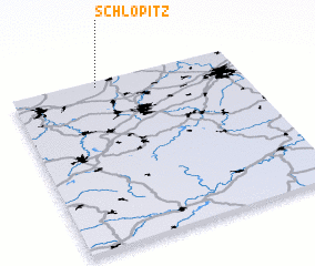 Places with similar names to Schlöpitz, Germany :: Disclaimer :: Information on this page comes without warranty of any kind |
||
|
Where is Schlöpitz? Elevation and coordinates ::
Latitude (lat): 50°58'0"N Longitude (lon): 12°23'0"E
Elevation (approx.): 210m (map arrows pan, magnifying glasses zoom) |
||
|
Visiting Schlöpitz? Hotel/Accommodation ::
Book a hotel in Schlöpitz Travel Guide ::
Buy a travel guide for Germany rental cars ::
car rental offers GPS waypoint ::
download a GPX waypoint (PoI) of Schlöpitz for your GPS receiver
|
||