|
search place name
|
||
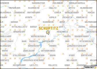
Schüptitz (Thüringen, Germany)Schüptitz is a town in the Thüringen region of Germany. An overview map of the region around Schüptitz is displayed below.
regional and 3d topo map of Schüptitz, Germany ::
Schüptitz airports ::
The nearest airport is AOC - Altenburg Nobitz, located 44.2 km north east of Schüptitz.
Other airports nearby include HOQ - Hof Plauen (50.8 km south), LEJ - Leipzig Halle (79.4 km north), ERF - Erfurt (79.4 km west), KLV - Karlovy Vary (86.9 km south east), Nearby towns ::
Göhren-Döhlen (1.9km south) //
Staitz (2.2km south west) //
Dörtendorf (3.7km south) //
Loitsch (2.3km east) //
Schömberg (3.7km north) //
Hohenleuben (3.0km south east) //
Kuhberg (3.0km north east) //
Gräfenbruck (3.0km north east) //
Steinsdorf (3.0km north east) //
Bermichsmühle (3.0km south west) //
Liebsdorf (3.9km north) //
Rohna (3.0km north west) //
Grochwitz (3.9km north) //
Brückla (4.4km south east) //
Neundorf (4.4km north west) //
Hirschbach (3.5km east) //
Forstwolfersdorf (3.5km west) //
Burkersdorf (5.6km north) //
Triebes (5.7km south) //
Wöhlsdorf (4.0km south west) //
Köfeln (5.7km north) //
Weißendorf (5.7km south) //
Kranich (5.7km south) //
Birkigt (4.0km north west) //
Niederpöllnitz (4.0km north west) //
Piesigitz (5.1km south west) //
Köckritz (6.0km north east) //
Weida (5.1km north east) //
Frießnitz (6.0km north west) //
[all distances 'as the bird flies' and approximate] 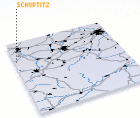 Places with similar names to Schüptitz, Germany :: Disclaimer :: Information on this page comes without warranty of any kind |
||
|
Where is Schüptitz? Elevation and coordinates ::
Latitude (lat): 50°44'0"N Longitude (lon): 12°1'0"E
Elevation (approx.): 363m (map arrows pan, magnifying glasses zoom) |
||
|
Visiting Schüptitz? Hotel/Accommodation ::
Book a hotel in Schüptitz Travel Guide ::
Buy a travel guide for Germany rental cars ::
car rental offers GPS waypoint ::
download a GPX waypoint (PoI) of Schüptitz for your GPS receiver
|
||