|
search place name
|
||
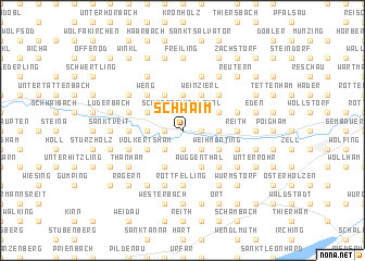
Schwaim (Bayern, Germany)Schwaim is a town in the Bayern region of Germany. An overview map of the region around Schwaim is displayed below.
regional and 3d topo map of Schwaim, Germany ::
Schwaim airports ::
The nearest airport is SZG - Salzburg, located 70.6 km south of Schwaim.
Other airports nearby include LNZ - Linz (Horsching) (77.2 km east), MUC - Munich Munchen (103.7 km west), FEL - Fuerstenfeldbruck Furstenfeldbruck (144.1 km west), OBF - Oberpfaffenhofen (146.0 km west), Nearby towns ::
Kindlbach (1.2km west) //
Schwarz im Höllthal (1.9km north) //
Oberham (1.9km north) //
Singham (1.2km east) //
Maierhof (1.9km south) //
Penning (1.9km south) //
Asbach (1.9km south) //
Aicha (2.2km north west) //
Priel (2.2km south west) //
Aunham (2.2km north east) //
Hellham (2.2km south west) //
Holzhäuser (2.2km south east) //
Wopping (2.2km south east) //
Bayerbach (2.5km west) //
Leithen (3.7km north) //
Maierhof (3.7km north) //
Karpfham (2.5km east) //
Holzham (3.1km north west) //
Amsham (3.9km north) //
Volkertsham (3.1km south west) //
Neugertsham (3.1km south west) //
Langwinkl (3.1km south west) //
Weinzierl (3.9km north) //
Griesbach (3.9km north) //
Kronberg (3.9km north) //
Inham (3.9km north) //
Katzham (3.9km north) //
Baumgarten (3.1km north east) //
Afham (3.1km north east) //
[all distances 'as the bird flies' and approximate] 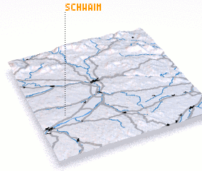 Places with similar names to Schwaim, Germany ::
Disclaimer :: Information on this page comes without warranty of any kind |
||
|
Where is Schwaim? Elevation and coordinates ::
Latitude (lat): 48°25'0"N Longitude (lon): 13°11'0"E
Elevation (approx.): 334m (map arrows pan, magnifying glasses zoom) |
||
|
Visiting Schwaim? Hotel/Accommodation ::
Book a hotel in Schwaim Travel Guide ::
Buy a travel guide for Germany rental cars ::
car rental offers GPS waypoint ::
download a GPX waypoint (PoI) of Schwaim for your GPS receiver
|
||