|
search place name
|
||
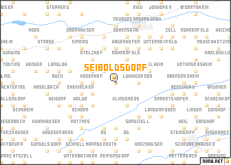
Seiboldsdorf (Bayern, Germany)Seiboldsdorf is a town in the Bayern region of Germany. An overview map of the region around Seiboldsdorf is displayed below.
regional and 3d topo map of Seiboldsdorf, Germany ::
Seiboldsdorf airports ::
The nearest airport is AGB - Augsburg, located 29.7 km south west of Seiboldsdorf.
Other airports nearby include FEL - Fuerstenfeldbruck Furstenfeldbruck (50.2 km south), MUC - Munich Munchen (57.4 km south east), OBF - Oberpfaffenhofen (64.0 km south), NUE - Nuernberg Nurnberg (94.6 km north), Nearby towns ::
Dinkelshausen (0.0km north) //
Kehrhof (0.0km north) //
Hollenbach (2.2km north west) //
Ludwigsmoos (2.4km east) //
Kagerhof (2.4km west) //
Klingsmoos (3.9km south) //
Fernmittenhausen (3.1km north west) //
Nähermittenhausen (3.1km north west) //
Wallertshofen (3.1km south west) //
Rohrenfels (3.9km north) //
Baiern (3.9km north) //
Schainbach (4.4km south west) //
Stelzhof (4.4km north west) //
Ambach (3.7km west) //
Ergertshausen (5.6km north) //
Stengelheim (4.1km north east) //
Ried (4.1km south west) //
Ehekirchen (4.1km south west) //
Schönesberg (4.1km south west) //
Ballersdorf (5.7km north) //
Doferhof (5.7km north) //
Wagenhofen (5.7km north) //
Malzhausen (6.1km south east) //
Walda (5.2km south west) //
Altmannstetten (6.1km north east) //
Grimolzhausen (7.4km south) //
Kreut (7.5km north) //
Gnadenfeld (7.5km north) //
Sehensand (7.5km north) //
[all distances 'as the bird flies' and approximate] 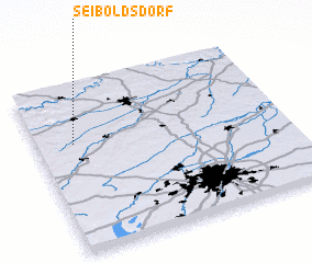 Places with similar names to Seiboldsdorf, Germany ::
// Seyboldsdorf (DE)
Disclaimer :: Information on this page comes without warranty of any kind |
||
|
Where is Seiboldsdorf? Elevation and coordinates ::
Latitude (lat): 48°39'0"N Longitude (lon): 11°9'0"E
Elevation (approx.): 403m (map arrows pan, magnifying glasses zoom) |
||
|
Visiting Seiboldsdorf? Hotel/Accommodation ::
Book a hotel in Seiboldsdorf Travel Guide ::
Buy a travel guide for Germany rental cars ::
car rental offers GPS waypoint ::
download a GPX waypoint (PoI) of Seiboldsdorf for your GPS receiver
|
||