|
search place name
|
||
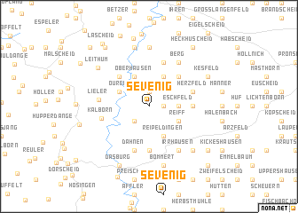
Sevenig (Rheinland-Pfalz, Germany)Sevenig is a town in the Rheinland-Pfalz region of Germany. An overview map of the region around Sevenig is displayed below.
regional and 3d topo map of Sevenig, Germany ::
Sevenig airports ::
The nearest airport is SPM - Spangdahlem Ab, located 40.9 km south east of Sevenig.
Other airports nearby include ZQF - Trier Fohren (52.7 km south east), LUX - Luxemburg Luxembourg (54.6 km south), LGG - Liege (77.5 km north west), HHN - Frankfurt Hahn (80.8 km east), Nearby towns ::
Harspelt (1.9km north) //
Roscheid (1.2km east) //
Dahnerstraße (2.2km south west) //
Eschfeld (2.4km east) //
Lützkampen (3.9km north) //
Oberhausen (3.9km north) //
Welchenhausen (3.9km north) //
Reiff (3.0km south east) //
Ouren (3.0km north west) //
Reipeldingen (3.9km south) //
Großkampenberg (4.4km north east) //
Peterskirche (4.4km north west) //
Sengerich (3.6km east) //
Daleiden (5.6km south) //
Auf dem Bock (5.7km north) //
Herzfeld (4.0km north east) //
Leidenborn (4.0km north east) //
Karschelt (5.7km south) //
Dahnen (5.7km south) //
Kalborn (4.1km west) //
Lieler (4.1km west) //
Berg (6.0km north east) //
Irrhausen (6.0km south east) //
Diepert (7.4km north) //
Stoubach (7.5km north) //
Weidig (7.5km north) //
Bommert (7.5km south) //
Olmscheid (6.6km south east) //
Leithum (6.4km north west) //
[all distances 'as the bird flies' and approximate] 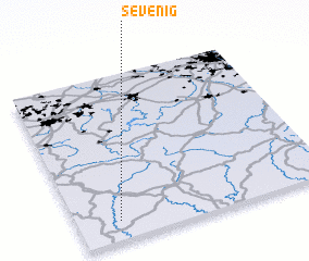 Places with similar names to Sevenig, Germany ::
Disclaimer :: Information on this page comes without warranty of any kind |
||
|
Where is Sevenig? Elevation and coordinates ::
Latitude (lat): 50°7'0"N Longitude (lon): 6°10'0"E
Elevation (approx.): 485m (map arrows pan, magnifying glasses zoom) |
||
|
Visiting Sevenig? Hotel/Accommodation ::
Book a hotel in Sevenig Travel Guide ::
Buy a travel guide for Germany rental cars ::
car rental offers GPS waypoint ::
download a GPX waypoint (PoI) of Sevenig for your GPS receiver
|
||