|
search place name
|
||
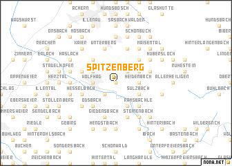
Spitzenberg (Baden-Württemberg, Germany)Spitzenberg is a town in the Baden-Württemberg region of Germany. An overview map of the region around Spitzenberg is displayed below.
regional and 3d topo map of Spitzenberg, Germany ::
Spitzenberg airports ::
The nearest airport is ZCC - Baden-baden Baden Oos, located 29.2 km north of Spitzenberg.
Other airports nearby include SXB - Strassbourg Entzheim (36.1 km west), ZQL - Donaueschingen Villingen (69.2 km south east), CMR - Colmar Houssen (73.3 km south west), STR - Stuttgart (83.3 km east), Nearby towns ::
Steig (0.0km north) //
Wolfersbach (2.2km north east) //
Simmersbach (2.2km north east) //
Lautenbach (2.2km south west) //
Vordere Allmend (2.2km south west) //
Winterbach (2.2km south west) //
Sendelbach (2.2km south west) //
Heidenbach (2.5km east) //
Wolfhag (2.5km west) //
Hungerberg (2.5km west) //
Gaisbach (2.5km west) //
Oberkirch (2.5km west) //
Hilsen (2.5km west) //
Sulzbach (3.1km south east) //
Ramsbach (3.9km south) //
Unterwasser (3.1km north east) //
Niederlehen (3.1km north west) //
Ramsbächle (4.4km south east) //
Ottenhöfen im Schwarzwald (4.4km north east) //
Ödsbach (4.4km south west) //
Ringelback (4.4km north west) //
Oberberg (4.4km north west) //
Furschenbach (5.7km north) //
Hesselbach (4.1km south west) //
Butschbach (4.1km south west) //
Bärenbach (5.7km south) //
Hubneck (4.1km north west) //
Weiher (5.7km north) //
Winterbürg (5.7km north) //
[all distances 'as the bird flies' and approximate] 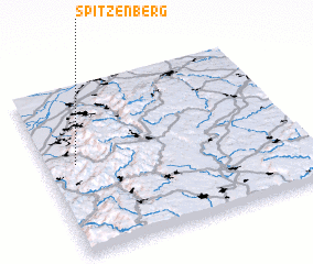 Places with similar names to Spitzenberg, Germany ::
// Spitzenburg (AT)
// Spitzenberg (US)
Disclaimer :: Information on this page comes without warranty of any kind |
||
|
Where is Spitzenberg? Elevation and coordinates ::
Latitude (lat): 48°32'0"N Longitude (lon): 8°7'0"E
Elevation (approx.): 445m (map arrows pan, magnifying glasses zoom) |
||
|
Visiting Spitzenberg? Hotel/Accommodation ::
Book a hotel in Spitzenberg Travel Guide ::
Buy a travel guide for Germany rental cars ::
car rental offers GPS waypoint ::
download a GPX waypoint (PoI) of Spitzenberg for your GPS receiver
|
||