|
search place name
|
||
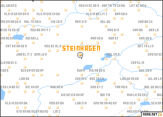
Steinhagen (Mecklenburg-Vorpommern, Germany)Steinhagen is a town in the Mecklenburg-Vorpommern region of Germany. An overview map of the region around Steinhagen is displayed below.
regional and 3d topo map of Steinhagen, Germany ::
Steinhagen airports ::
The nearest airport is RLG - Laage, located 23.9 km east of Steinhagen.
Other airports nearby include SZW - Schwerin Parchim (48.1 km south), LBC - Luebeck Lubeck Blankensee (80.1 km west), HAM - Hamburg (130.6 km west), KEL - Kiel Holtenau (130.9 km north west), Nearby towns ::
Kurzen Trechow (2.2km north west) //
Neuendorf (2.2km north east) //
Langen Trechow (3.7km north) //
Rühn (3.7km south) //
Parkow (4.3km north east) //
Vierburg (4.3km south east) //
Bützow (3.3km east) //
Zernin (5.6km south) //
Neu Schlemmin (3.8km north west) //
Baumgarten (5.0km south west) //
Peetsch (6.0km south) //
Penzin (7.4km north) //
Wolken (4.4km east) //
Schlemmin (4.7km north west) //
Bernitt (6.5km north west) //
Horst (5.7km north east) //
Dreetz (7.7km south) //
Warnow (8.1km south west) //
Viezen (8.1km north west) //
Passin (7.1km north east) //
Selow (8.1km north east) //
Zibühl (7.1km south east) //
[all distances 'as the bird flies' and approximate] 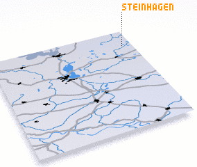 Places with similar names to Steinhagen, Germany ::
// Steinhagen (DE)
// Steinhagen (DE)
// Steinhagen (DE)
// Steinhagen (DE)
// Steinhagen (DE)
// Stenhagen (SE)
// Stenhagen (SE)
Disclaimer :: Information on this page comes without warranty of any kind |
||
|
Where is Steinhagen? Elevation and coordinates ::
Latitude (lat): 53°51'0"N Longitude (lon): 11°56'0"E
Elevation (approx.): 16m (map arrows pan, magnifying glasses zoom) |
||
|
Visiting Steinhagen? Hotel/Accommodation ::
Book a hotel in Steinhagen Travel Guide ::
Buy a travel guide for Germany rental cars ::
car rental offers GPS waypoint ::
download a GPX waypoint (PoI) of Steinhagen for your GPS receiver
|
||