|
search place name
|
||
Strullendorf (Bayern, Germany)Strullendorf is a town in the Bayern region of Germany. An overview map of the region around Strullendorf is displayed below.
regional and 3d topo map of Strullendorf, Germany ::

Strullendorf airports ::
The nearest airport is NUE - Nuernberg Nurnberg, located 37.7 km south of Strullendorf.
Other airports nearby include BYU - Bayreuth (50.0 km east), GHF - Giebelstadt Aaf (76.1 km west), HOQ - Hof Plauen (80.4 km north east), ERF - Erfurt (127.5 km north), Nearby towns ::
Hirschaid (1.6km south) //
Amlingstadt (2.2km north east) //
Sassanfahrt (3.7km south) //
Juliushof (3.9km south) //
Köttmannsdorf (3.9km south) //
Seußling (3.9km south) //
Roßdorf (3.9km north) //
Erlach (4.4km south west) //
Altendorf (4.4km south east) //
Leesten (4.4km north east) //
Wernsdorf (4.4km north east) //
Mistendorf (4.4km north east) //
Schadlos (3.6km west) //
Friesen (3.6km east) //
Pettstadt (3.6km west) //
Großbuchfeld (5.7km south) //
Rothensand (5.7km south) //
Kleinbuchfeld (5.7km south) //
Seigendorf (4.0km south east) //
Buttenheim (5.2km south east) //
Geisfeld (6.1km north east) //
Hallerndorf (7.4km south) //
Neuhaus (4.8km west) //
Eichenhof (4.8km west) //
Trailsdorf (7.5km south) //
Schlammersdorf (7.5km south) //
Kunigundenruh (7.5km north) //
Naisa (7.5km north) //
Schnaid (7.8km south) //
[all distances 'as the bird flies' and approximate] 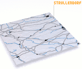 Places with similar names to Strullendorf, Germany ::
// Stralendorf (DE)
// Stralendorf (DE)
Disclaimer :: Information on this page comes without warranty of any kind |
||
|
Where is Strullendorf? Elevation and coordinates ::
Latitude (lat): 49°50'0"N Longitude (lon): 10°59'0"E
Elevation (approx.): 249m (map arrows pan, magnifying glasses zoom) |
||
|
Visiting Strullendorf? Hotel/Accommodation ::
Book a hotel in Strullendorf Travel Guide ::
Buy a travel guide for Germany rental cars ::
car rental offers GPS waypoint ::
download a GPX waypoint (PoI) of Strullendorf for your GPS receiver
|
||