|
search place name
|
||
Surendorf (Schleswig-Holstein, Germany)Surendorf is a town in the Schleswig-Holstein region of Germany. An overview map of the region around Surendorf is displayed below.
regional and 3d topo map of Surendorf, Germany ::

Surendorf airports ::
The nearest airport is KEL - Kiel Holtenau, located 12.6 km south east of Surendorf.
Other airports nearby include SGD - Soenderborg Sonderborg (56.4 km north), LBC - Luebeck Lubeck Blankensee (86.7 km south east), HAM - Hamburg (95.1 km south), SKS - Skrydstrup (97.4 km north west), Nearby towns ::
Krusendorf (2.1km south west) //
Jellenbek (2.1km south west) //
Birkenmoor (3.7km south) //
Kuhholzberg (4.3km south east) //
Dänisch Nienhof (3.2km east) //
Kaltenhof (5.7km south) //
Sprenge (3.7km south east) //
Stubbendorf (4.9km south west) //
Krück (7.5km south) //
Felm (7.5km south) //
Noer (4.7km south west) //
Sturenhagen (6.4km south east) //
Osdorf (6.4km south west) //
Scharnhagen (5.7km south east) //
Dehnhöft (7.7km south) //
Rabendorf (5.7km south east) //
Dänischenhagen (7.0km south east) //
[all distances 'as the bird flies' and approximate] 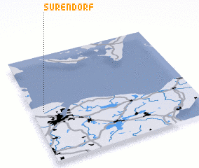 Places with similar names to Surendorf, Germany ::
// Sierndorf (AT)
// Zurndorf (AT)
// Sahrendorf (DE)
// Sahrendorf (DE)
// Sauerndorf (DE)
// Suhrendorf (DE)
// Zirndorf (DE)
// Zirndorf (DE)
// Zirndorf (DE)
// Zarrendorf (DE)
Disclaimer :: Information on this page comes without warranty of any kind |
||
|
Where is Surendorf? Elevation and coordinates ::
Latitude (lat): 54°29'0"N Longitude (lon): 10°4'0"E
Elevation (approx.): -32768m (map arrows pan, magnifying glasses zoom) |
||
|
Visiting Surendorf? Hotel/Accommodation ::
Book a hotel in Surendorf Travel Guide ::
Buy a travel guide for Germany rental cars ::
car rental offers GPS waypoint ::
download a GPX waypoint (PoI) of Surendorf for your GPS receiver
|
||