|
search place name
|
||
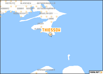
Thiessow (Mecklenburg-Vorpommern, Germany)Thiessow is a town in the Mecklenburg-Vorpommern region of Germany. An overview map of the region around Thiessow is displayed below.
regional and 3d topo map of Thiessow, Germany ::
Thiessow airports ::
The nearest airport is RLG - Laage, located 101.8 km west of Thiessow.
Other airports nearby include SZZ - Szczechin Goleniow (108.7 km south east), RNN - Bornholm Ronne (111.3 km north east), MMX - Malmoe Sturup (142.4 km north), SZW - Schwerin Parchim (157.9 km south west), Nearby towns ::
Klein Zicker (2.8km north west) //
Gager (4.3km north west) //
Groß Zicker (4.3km north west) //
Lobbe (5.6km north) //
Philippshagen (7.4km north) //
Ostseebad Göhren (7.5km north) //
Kleinhagen (7.5km north) //
Middelhagen (7.5km north) //
Alt Reddevitz (7.7km north) //
Mariendorf (7.7km north) //
[all distances 'as the bird flies' and approximate] 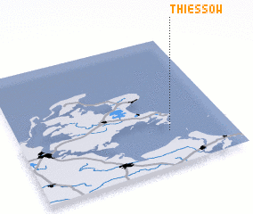 Places with similar names to Thiessow, Germany ::
Disclaimer :: Information on this page comes without warranty of any kind |
||
|
Where is Thiessow? Elevation and coordinates ::
Latitude (lat): 54°16'0"N Longitude (lon): 13°43'0"E
Elevation (approx.): -32768m (map arrows pan, magnifying glasses zoom) |
||
|
Visiting Thiessow? Hotel/Accommodation ::
Book a hotel in Thiessow Travel Guide ::
Buy a travel guide for Germany rental cars ::
car rental offers GPS waypoint ::
download a GPX waypoint (PoI) of Thiessow for your GPS receiver
|
||