|
search place name
|
||
Urleben (Thüringen, Germany)Urleben is a town in the Thüringen region of Germany. An overview map of the region around Urleben is displayed below.
regional and 3d topo map of Urleben, Germany ::

Urleben airports ::
The nearest airport is ERF - Erfurt, located 22.6 km south east of Urleben.
Other airports nearby include KSF - Kassel Calden (102.2 km west), LEJ - Leipzig Halle (106.5 km east), HOQ - Hof Plauen (122.1 km south east), AOC - Altenburg Nobitz (122.2 km east), Nearby towns ::
Großurleben (2.2km north west) //
Kleinurleben (2.2km north west) //
Kleinvargula (2.2km south east) //
Großvargula (3.7km south) //
Klettstedt (2.3km west) //
Bruchstedt (3.7km north) //
Tottleben (3.0km north west) //
Haussömmern (4.4km north east) //
Bad Tennstedt (3.5km east) //
Herbsleben (5.1km south east) //
Blankenburg (6.0km north west) //
Kutzleben (6.0km north west) //
Mittelsömmern (6.0km north east) //
Sundhausen (5.0km west) //
Gräfentonna (6.6km south west) //
Nägelstedt (5.9km south west) //
Döllstädt (7.8km south) //
Hornsömmern (7.8km north) //
Rohnstedt (8.2km north east) //
Felsenkeller (8.2km south west) //
[all distances 'as the bird flies' and approximate] 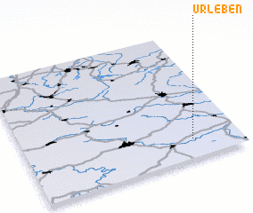 Places with similar names to Urleben, Germany :: Disclaimer :: Information on this page comes without warranty of any kind |
||
|
Where is Urleben? Elevation and coordinates ::
Latitude (lat): 51°9'0"N Longitude (lon): 10°47'0"E
Elevation (approx.): 204m (map arrows pan, magnifying glasses zoom) |
||
|
Visiting Urleben? Hotel/Accommodation ::
Book a hotel in Urleben Travel Guide ::
Buy a travel guide for Germany rental cars ::
car rental offers GPS waypoint ::
download a GPX waypoint (PoI) of Urleben for your GPS receiver
|
||