|
search place name
|
||
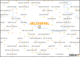
Waldkappel (Hessen, Germany)Waldkappel is a town in the Hessen region of Germany. An overview map of the region around Waldkappel is displayed below.
regional and 3d topo map of Waldkappel, Germany ::
Waldkappel airports ::
The nearest airport is KSF - Kassel Calden, located 45.5 km north west of Waldkappel.
Other airports nearby include ERF - Erfurt (77.7 km east), PAD - Paderborn Lippstadt (102.2 km north west), ZNF - Hanau Aaf (127.1 km south west), BWE - Braunschweig Wolfsburg (138.1 km north), Nearby towns ::
Rodebach (2.2km north west) //
Harmuthsachsen (2.3km west) //
Rechtebach (3.9km south) //
Kirchhosbach (3.9km south) //
Friemen (4.4km south west) //
Thurnhosbach (5.7km south) //
Vierbach (3.9km north east) //
Bischhausen (4.0km south east) //
Mäckelsdorf (4.0km south west) //
Germerode (5.7km north) //
Vockerode (5.7km north) //
Burghofen (5.1km south west) //
Alberode (5.1km north east) //
Mitterode (6.0km south east) //
Stadthosbach (7.4km south) //
Hasselbach (5.0km west) //
Küchen (5.0km west) //
Wellingerode (6.6km south east) //
Abterode (6.6km north east) //
Schemmern (5.9km south west) //
Wolfterode (7.8km north) //
Hausen (7.2km north west) //
Eltmannsee (8.8km south west) //
[all distances 'as the bird flies' and approximate] 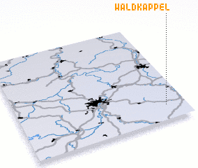 Places with similar names to Waldkappel, Germany :: Disclaimer :: Information on this page comes without warranty of any kind |
||
|
Where is Waldkappel? Elevation and coordinates ::
Latitude (lat): 51°9'0"N Longitude (lon): 9°53'0"E
Elevation (approx.): 245m (map arrows pan, magnifying glasses zoom) |
||
|
Visiting Waldkappel? Hotel/Accommodation ::
Book a hotel in Waldkappel Travel Guide ::
Buy a travel guide for Germany rental cars ::
car rental offers GPS waypoint ::
download a GPX waypoint (PoI) of Waldkappel for your GPS receiver
|
||