|
search place name
|
||
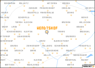
Wendtshof (Brandenburg, Germany)Wendtshof is a town in the Brandenburg region of Germany. An overview map of the region around Wendtshof is displayed below.
regional and 3d topo map of Wendtshof, Germany ::
Wendtshof airports ::
The nearest airport is SZZ - Szczechin Goleniow, located 60.6 km north east of Wendtshof.
Other airports nearby include TXL - Berlin Tegel (103.9 km south west), THF - Berlin Tempelhof (109.0 km south west), SXF - Berlin Schonefeld (115.8 km south), RLG - Laage (133.2 km north west), Nearby towns ::
Carmzow (2.2km north west) //
Wallmow (2.2km south east) //
Cremzow (2.2km west) //
Grenz (3.9km south) //
Stramehl (5.6km north) //
Trampe (3.3km east) //
Rollberg (5.6km south) //
Albrechtshof (5.0km south east) //
Fahrenwalde (7.4km north) //
Kleptow (4.4km west) //
Ludwigshöhe (7.5km south) //
Eickstedt (7.5km south) //
Schwaneberg (6.5km south east) //
Ziemkendorf (6.5km south west) //
Brüssow (5.8km north east) //
Klockow (5.8km north west) //
Schmölln (7.7km south) //
Neuenfeld (8.1km north west) //
Damme (8.1km south west) //
[all distances 'as the bird flies' and approximate] 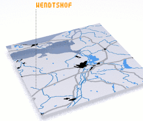 Places with similar names to Wendtshof, Germany ::
// Wendtshof (DE)
Disclaimer :: Information on this page comes without warranty of any kind |
||
|
Where is Wendtshof? Elevation and coordinates ::
Latitude (lat): 53°22'0"N Longitude (lon): 14°4'0"E
Elevation (approx.): 54m (map arrows pan, magnifying glasses zoom) |
||
|
Visiting Wendtshof? Hotel/Accommodation ::
Book a hotel in Wendtshof Travel Guide ::
Buy a travel guide for Germany rental cars ::
car rental offers GPS waypoint ::
download a GPX waypoint (PoI) of Wendtshof for your GPS receiver
|
||