|
search place name
|
||
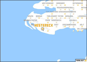
Westereck (Schleswig-Holstein, Germany)Westereck is a town in the Schleswig-Holstein region of Germany. An overview map of the region around Westereck is displayed below.
regional and 3d topo map of Westereck, Germany ::
Westereck airports ::
The nearest airport is GWT - Westerland Sylt, located 72.9 km north of Westereck.
Other airports nearby include BRV - Bremerhaven (86.5 km south), WVN - Wilhelmshaven Mariensiel (95.1 km south west), KEL - Kiel Holtenau (97.9 km east), SGD - Soenderborg Sonderborg (105.8 km north east), Nearby towns ::
Böhl (1.9km north) //
Süderhöft (1.1km east) //
Wittendün (2.1km north east) //
Sankt Peter-Ording (2.1km north west) //
Olsdorf (2.1km north west) //
Esing (3.9km north) //
Ehst (3.7km north east) //
Brösum (5.7km north) //
Otteresing (5.7km north) //
Tholendorf (6.0km north) //
Süderdeich (4.9km north east) //
Bad Sankt Peter (4.9km north west) //
Hauert (6.4km north east) //
Büttel (6.4km north east) //
Ording (6.4km north west) //
Tümlauer Koog (7.7km north) //
Lokert (7.0km north east) //
Osterende (7.0km north east) //
Tating (7.0km north east) //
[all distances 'as the bird flies' and approximate]  Places with similar names to Westereck, Germany ::
Disclaimer :: Information on this page comes without warranty of any kind |
||
|
Where is Westereck? Elevation and coordinates ::
Latitude (lat): 54°17'0"N Longitude (lon): 8°39'0"E
(map arrows pan, magnifying glasses zoom) |
||
|
Visiting Westereck? Hotel/Accommodation ::
Book a hotel in Westereck Travel Guide ::
Buy a travel guide for Germany rental cars ::
car rental offers GPS waypoint ::
download a GPX waypoint (PoI) of Westereck for your GPS receiver
|
||