|
search place name
|
||
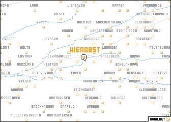
Wienöbst (Niedersachsen, Germany)Wienöbst is a town in the Niedersachsen region of Germany. An overview map of the region around Wienöbst is displayed below.
regional and 3d topo map of Wienöbst, Germany ::
Wienöbst airports ::
The nearest airport is FMO - Muenster/osnabrueck Munster Osnabruck, located 64.8 km south of Wienöbst.
Other airports nearby include ENS - Enschede Twenthe (75.8 km south west), BRE - Bremen (80.9 km north east), EME - Emden (81.9 km north west), GRQ - Groningen Eelde (88.7 km north west), Nearby towns ::
Schnetlage (1.1km east) //
Winkhof (1.9km south) //
Evenkamp (1.1km west) //
Werwe (1.1km west) //
Borkhorn (2.2km north east) //
Windhorst (3.9km north) //
Elbergen (3.9km north) //
Helmighausen (2.9km north west) //
Ehren (3.9km south) //
Gravenholt (4.3km north east) //
Lewinghausen (3.4km west) //
Angelbeck (3.4km east) //
Augustenfeld (5.6km north) //
Hahnenmoor (5.7km south) //
Löningen (3.8km north east) //
Düenkamp (3.8km south west) //
Meerdorf (5.0km north east) //
Vehrensande (6.0km north) //
Winkum (5.0km south east) //
Aselage (5.0km south west) //
Vinnen (6.0km north) //
Wachtum (7.4km north) //
Teichhausen (7.4km south) //
Böen (4.9km east) //
Röpke (4.9km east) //
Westrum (4.9km west) //
Börstel (7.5km south) //
Madlage (6.5km north east) //
Hollrah (5.8km south east) //
[all distances 'as the bird flies' and approximate] 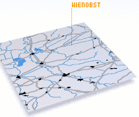 Places with similar names to Wienöbst, Germany :: Disclaimer :: Information on this page comes without warranty of any kind |
||
|
Where is Wienöbst? Elevation and coordinates ::
Latitude (lat): 52°43'0"N Longitude (lon): 7°43'0"E
Elevation (approx.): 23m (map arrows pan, magnifying glasses zoom) |
||
|
Visiting Wienöbst? Hotel/Accommodation ::
Book a hotel in Wienöbst Travel Guide ::
Buy a travel guide for Germany rental cars ::
car rental offers GPS waypoint ::
download a GPX waypoint (PoI) of Wienöbst for your GPS receiver
|
||