|
search place name
|
||
Willingshain (Hessen, Germany)Willingshain is a town in the Hessen region of Germany. An overview map of the region around Willingshain is displayed below.
regional and 3d topo map of Willingshain, Germany ::

Willingshain airports ::
The nearest airport is KSF - Kassel Calden, located 61.0 km north of Willingshain.
Other airports nearby include ZNF - Hanau Aaf (87.0 km south west), ERF - Erfurt (102.1 km east), PAD - Paderborn Lippstadt (104.2 km north west), FRA - Frankfurt Main (116.3 km south west), Nearby towns ::
Frielingen (1.9km south) //
Gersdorf (1.9km south) //
Salzberg (3.9km north) //
Heddersdorf (3.0km south east) //
Allendorf (3.9km south) //
Wahlshausen (3.0km south west) //
Friedigerode (3.5km west) //
Rotterterode (3.5km east) //
Kemmerode (5.6km south) //
Raboldshausen (5.7km north) //
Reimboldshausen (5.7km south) //
Oberaula (4.0km south west) //
Saasen (6.0km north east) //
Gershausen (6.0km south east) //
Kirchheim (5.1km south east) //
Ibra (6.0km south west) //
Goßmannsrode (5.0km east) //
Aua (6.6km north east) //
Grebenhagen (6.6km north west) //
Obergeis (6.0km north east) //
Mühlbach (7.8km north) //
Oberappenfeld (7.8km north) //
Niederappenfeld (7.8km north) //
Hattenbach (7.8km south) //
Hausen (6.0km south west) //
Machtlos (7.8km south) //
Kleba (7.3km south east) //
Schwarzenborn (7.3km north west) //
Appenfeld (8.8km north west) //
[all distances 'as the bird flies' and approximate] 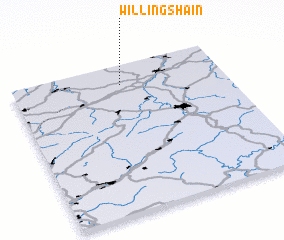 Places with similar names to Willingshain, Germany ::
Disclaimer :: Information on this page comes without warranty of any kind |
||
|
Where is Willingshain? Elevation and coordinates ::
Latitude (lat): 50°52'0"N Longitude (lon): 9°31'0"E
Elevation (approx.): 434m (map arrows pan, magnifying glasses zoom) |
||
|
Visiting Willingshain? Hotel/Accommodation ::
Book a hotel in Willingshain Travel Guide ::
Buy a travel guide for Germany rental cars ::
car rental offers GPS waypoint ::
download a GPX waypoint (PoI) of Willingshain for your GPS receiver
|
||