|
search place name
|
||
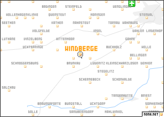
Windberge (Sachsen-Anhalt, Germany)Windberge is a town in the Sachsen-Anhalt region of Germany. An overview map of the region around Windberge is displayed below.
regional and 3d topo map of Windberge, Germany ::
Windberge airports ::
The nearest airport is BWE - Braunschweig Wolfsburg, located 82.0 km west of Windberge.
Other airports nearby include SZW - Schwerin Parchim (101.4 km north), TXL - Berlin Tegel (106.7 km east), THF - Berlin Tempelhof (114.7 km east), ZCN - Celle (115.2 km west), Nearby towns ::
Schleuß (1.1km east) //
Ottersburg (1.1km west) //
Brunkau (2.2km south west) //
Lüderitz (2.9km south east) //
Großschwarzlosen (2.9km south east) //
Wittenmoor (4.3km north west) //
Vollenschier (3.9km north west) //
Schernebeck (5.7km south) //
Insel (6.0km north) //
Stegelitz (5.0km south east) //
Nahrstedt (7.4km north) //
Buchholz (4.9km east) //
Deetz (8.1km north west) //
Käthen (8.1km north west) //
Döbbelin (8.7km north east) //
Tornau (8.7km north east) //
[all distances 'as the bird flies' and approximate] 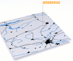 Places with similar names to Windberge, Germany ::
// Wando Bridge (AU)
Disclaimer :: Information on this page comes without warranty of any kind |
||
|
Where is Windberge? Elevation and coordinates ::
Latitude (lat): 52°31'0"N Longitude (lon): 11°43'0"E
Elevation (approx.): 44m (map arrows pan, magnifying glasses zoom) |
||
|
Visiting Windberge? Hotel/Accommodation ::
Book a hotel in Windberge Travel Guide ::
Buy a travel guide for Germany rental cars ::
car rental offers GPS waypoint ::
download a GPX waypoint (PoI) of Windberge for your GPS receiver
|
||