|
search place name
|
||
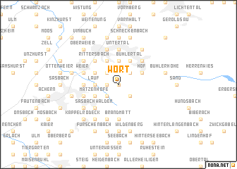
Wört (Baden-Württemberg, Germany)Wört is a town in the Baden-Württemberg region of Germany. An overview map of the region around Wört is displayed below.
regional and 3d topo map of Wört, Germany ::
Wört airports ::
The nearest airport is ZCC - Baden-baden Baden Oos, located 15.8 km north of Wört.
Other airports nearby include SXB - Strassbourg Entzheim (41.6 km west), ZQC - Speyer (75.5 km north), STR - Stuttgart (77.9 km east), ZQL - Donaueschingen Villingen (79.7 km south), Nearby towns ::
Bach (0.0km north) //
Aspich (1.2km west) //
Waldsteg (1.2km west) //
Gebersberg (1.2km west) //
Schönbücher Hütte (2.2km north east) //
Schönbüch (2.2km north east) //
Schwarzwasen (2.2km north east) //
Glashütte (2.2km south east) //
Neusatzeck (2.2km north east) //
Waldmatt (2.2km north west) //
Hornenberg (2.2km south west) //
Neusatz (2.2km north west) //
Schugshof (2.2km north west) //
Lochwald (2.2km south west) //
Lautenbächle (2.2km south west) //
Klotzberg (3.7km north) //
Lauf (2.4km west) //
Bühlertal (3.9km north) //
Haaberg (3.9km north) //
Hof (3.1km north east) //
Steckenhalt (3.1km north east) //
Längenberg (3.1km north east) //
Riegel (3.9km north) //
Hohbaum (3.9km north) //
Brombach (3.9km north) //
Matzenhöfe (3.1km south west) //
Hub (3.1km north west) //
Hungerberg (4.4km north east) //
Obertal (4.4km north east) //
[all distances 'as the bird flies' and approximate]  Places with similar names to Wört, Germany ::
Disclaimer :: Information on this page comes without warranty of any kind |
||
|
Where is Wört? Elevation and coordinates ::
Latitude (lat): 48°39'0"N Longitude (lon): 8°10'0"E
Elevation (approx.): 548m (map arrows pan, magnifying glasses zoom) |
||
|
Visiting Wört? Hotel/Accommodation ::
Book a hotel in Wört Travel Guide ::
Buy a travel guide for Germany rental cars ::
car rental offers GPS waypoint ::
download a GPX waypoint (PoI) of Wört for your GPS receiver
|
||