|
search place name
|
||
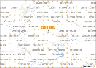
Zeißau (Bayern, Germany)Zeißau is a town in the Bayern region of Germany. An overview map of the region around Zeißau is displayed below.
regional and 3d topo map of Zeißau, Germany ::
Zeißau airports ::
The nearest airport is BYU - Bayreuth, located 60.5 km north west of Zeißau.
Other airports nearby include HOQ - Hof Plauen (81.3 km north), KLV - Karlovy Vary (83.0 km north east), NUE - Nuernberg Nurnberg (85.2 km west), MUC - Munich Munchen (142.4 km south), Nearby towns ::
Matzlesberg (1.2km west) //
Engleshof (1.2km west) //
Lückenrieth (1.2km east) //
Leuchtenberg (1.2km east) //
Irchenrieth (1.9km north) //
Schwarzberg (2.2km south west) //
Hermannsberg (2.2km north east) //
Michldorf (2.2km north east) //
Woppenhof (3.9km south) //
Deindorf (3.9km south) //
Enzenrieth (3.0km north west) //
Preppach (3.9km south) //
Wittschau (3.9km south) //
Kleinpoppenhof (3.0km north east) //
Alletshof (4.4km south west) //
Glaubendorf (4.4km south west) //
Kaimling (4.4km north east) //
Döllnitz (4.4km south east) //
Ödenthal (5.6km north) //
Maztlesrieth (5.6km north) //
Muglhof (5.6km north) //
Seibertshof (3.6km west) //
Lerau (3.6km east) //
Söllitz (5.6km south) //
Bechtsrieth (5.7km north) //
Trebsau (5.7km north) //
Unterhöll (5.7km north) //
Losau (5.7km south) //
Trauschendorf (5.7km north) //
[all distances 'as the bird flies' and approximate] 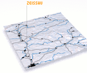 Places with similar names to Zeißau, Germany ::
Disclaimer :: Information on this page comes without warranty of any kind |
||
|
Where is Zeißau? Elevation and coordinates ::
Latitude (lat): 49°36'0"N Longitude (lon): 12°14'0"E
Elevation (approx.): 456m (map arrows pan, magnifying glasses zoom) |
||
|
Visiting Zeißau? Hotel/Accommodation ::
Book a hotel in Zeißau Travel Guide ::
Buy a travel guide for Germany rental cars ::
car rental offers GPS waypoint ::
download a GPX waypoint (PoI) of Zeißau for your GPS receiver
|
||