|
search place name
|
||
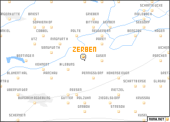
Zerben (Sachsen-Anhalt, Germany)Zerben is a town in the Sachsen-Anhalt region of Germany. An overview map of the region around Zerben is displayed below.
regional and 3d topo map of Zerben, Germany ::
Zerben airports ::
The nearest airport is TXL - Berlin Tegel, located 93.9 km east of Zerben.
Other airports nearby include BWE - Braunschweig Wolfsburg (95.1 km west), THF - Berlin Tempelhof (99.9 km east), LEJ - Leipzig Halle (104.0 km south), SXF - Berlin Schonefeld (107.2 km east), Nearby towns ::
Güsen (2.3km east) //
Ihleburg (2.9km south west) //
Pennigsdorf (3.9km south) //
Parey (4.3km north east) //
Polte (5.7km north) //
Ringfurth (5.0km north west) //
Neuderben (6.0km north) //
Bittkau (7.5km north) //
Reesen (7.5km south) //
Sandfurth (4.9km west) //
Brehm (7.8km south) //
Parchau (5.9km south west) //
Hohenseeden (5.9km south east) //
Derbenscheberg (8.2km north east) //
Derben (8.2km north east) //
Scheeren (8.7km north west) //
Rietzel (8.7km south east) //
[all distances 'as the bird flies' and approximate] 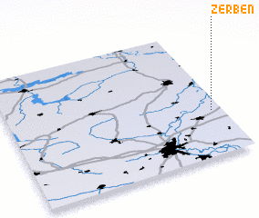 Places with similar names to Zerben, Germany ::
Disclaimer :: Information on this page comes without warranty of any kind |
||
|
Where is Zerben? Elevation and coordinates ::
Latitude (lat): 52°21'0"N Longitude (lon): 11°57'0"E
Elevation (approx.): 35m (map arrows pan, magnifying glasses zoom) |
||
|
Visiting Zerben? Hotel/Accommodation ::
Book a hotel in Zerben Travel Guide ::
Buy a travel guide for Germany rental cars ::
car rental offers GPS waypoint ::
download a GPX waypoint (PoI) of Zerben for your GPS receiver
|
||