|
search place name
|
||
Adria (Italy)Adria is a town in Italy. An overview map of the region around Adria is displayed below.
regional and 3d topo map of Adria, Italy ::

Adria airports ::
The nearest airport is TRS - Ronchi De Legionari Ronchi Dei Legionari, located 11.0 km north of Adria.
Other airports nearby include POW - Portoroz (29.9 km south), AVB - Aviano Ab (Pagliano E Gori) (78.8 km north west), LJU - Ljubliana Ljubljana (91.0 km north east), VCE - Venice Venezia Tessera (94.3 km west), Nearby towns ::
Sdobba (0.0km north) //
Golometto (2.2km south) //
Fossalòn (1.8km west) //
Alberone (2.7km north) //
Panzano Bagni (6.0km north) //
Bistrigna (6.8km north) //
Panzano (7.1km north) //
Casa Rougna (5.5km west) //
Staranzano (8.3km north) //
Monfalcone (8.3km north) //
San Canzian dʼlsonzo (8.1km north west) //
Villággio del Pescatore (7.6km north east) //
Dòbbia (9.2km north) //
Pieris (10.0km north west) //
[all distances 'as the bird flies' and approximate] 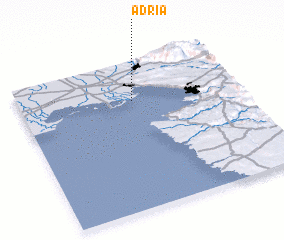 Places with similar names to Adria, Italy ::
Disclaimer :: Information on this page comes without warranty of any kind |
||
|
Where is Adria? Elevation and coordinates ::
Latitude (lat): 45°44'0"N Longitude (lon): 13°31'0"E
Elevation (approx.): -3m (map arrows pan, magnifying glasses zoom) |
||
|
Visiting Adria? Hotel/Accommodation ::
Book a hotel in Adria Travel Guide ::
Buy a travel guide for Italy rental cars ::
car rental offers GPS waypoint ::
download a GPX waypoint (PoI) of Adria for your GPS receiver
|
||