|
search place name
|
||
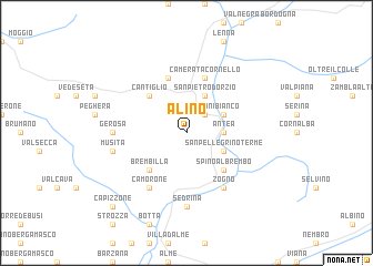
Alino (Italy)Alino is a town in Italy. An overview map of the region around Alino is displayed below.
regional and 3d topo map of Alino, Italy ::
Alino airports ::
The nearest airport is BGY - Bergamo Orio Al Serio, located 20.3 km south of Alino.
Other airports nearby include LIN - Milan Linate (52.9 km south west), LUG - Lugano (58.6 km west), VBS - Montichiari (71.7 km south east), MXP - Milano Malpensa (74.5 km west), Nearby towns ::
San Giovanni Bianco (2.3km north east) //
Antea (2.6km east) //
San Pietro dʼOrzio (3.9km north) //
Grumo (3.9km north) //
Piazzo Basso (3.2km south east) //
San Pellegrino Terme (3.2km south east) //
Madonna della Costa (3.2km north east) //
Cantiglio (4.5km north west) //
Costa di Bassano (4.5km north west) //
Brembilla (4.5km south west) //
Spino al Brembo (4.5km south east) //
Pianca (5.7km north) //
Camerata Cornello (5.7km north) //
Camorone (6.1km south west) //
Zogno (6.1km south east) //
Gerosa (5.2km west) //
Sedrina (7.4km south) //
Musita (5.5km west) //
Capizzone (9.0km south west) //
[all distances 'as the bird flies' and approximate]  Places with similar names to Alino, Italy ::
Disclaimer :: Information on this page comes without warranty of any kind |
||
|
Where is Alino? Elevation and coordinates ::
Latitude (lat): 45°51'0"N Longitude (lon): 9°38'0"E
Elevation (approx.): 1092m (map arrows pan, magnifying glasses zoom) |
||
|
Visiting Alino? Hotel/Accommodation ::
Book a hotel in Alino Travel Guide ::
Buy a travel guide for Italy rental cars ::
car rental offers GPS waypoint ::
download a GPX waypoint (PoI) of Alino for your GPS receiver
|
||