|
search place name
|
||
Aprilia (Italy)Aprilia is a town in Italy. An overview map of the region around Aprilia is displayed below.
regional and 3d topo map of Aprilia, Italy ::

Aprilia airports ::
The nearest airport is QLT - Latina, located 22.5 km east of Aprilia.
Other airports nearby include CIA - Rome Ciampino (22.6 km north), FCO - Rome Fiumicino (40.2 km north west), PSR - Pescara (156.9 km north east), NAP - Naples Capodichino (158.8 km south east), Nearby towns ::
Carroceto (2.3km south west) //
Casale della Mandria (2.3km north east) //
Casale Col Cavaliere (4.6km north east) //
Campo di Carne (5.7km south) //
Campoleone (6.2km north west) //
Carano (5.8km east) //
Casale di Padiglione (6.9km south east) //
Casale Nuovo Presciano (6.7km north east) //
Casale la Cogna (6.7km south west) //
Casalaccio (7.8km north east) //
Lanuvio (8.5km north east) //
[all distances 'as the bird flies' and approximate] 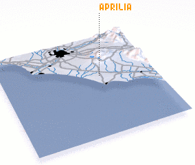
Disclaimer :: Information on this page comes without warranty of any kind |
||
|
Where is Aprilia? Elevation and coordinates ::
Latitude (lat): 41°36'0"N Longitude (lon): 12°39'0"E
Elevation (approx.): 82m (map arrows pan, magnifying glasses zoom) |
||
|
Visiting Aprilia? Hotel/Accommodation ::
Book a hotel in Aprilia Travel Guide ::
Buy a travel guide for Italy rental cars ::
car rental offers GPS waypoint ::
download a GPX waypoint (PoI) of Aprilia for your GPS receiver
|
||