|
search place name
|
||
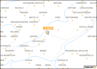
Baiso (Italy)Baiso is a town in Italy. An overview map of the region around Baiso is displayed below.
regional and 3d topo map of Baiso, Italy ::
Baiso airports ::
The nearest airport is PMF - Parma, located 43.4 km north west of Baiso.
Other airports nearby include BLQ - Bologna (54.9 km east), QPZ - Piacenza (83.3 km north west), FLR - Firenze (90.7 km south east), PSA - Pisa (92.2 km south), Nearby towns ::
Castagneto (2.3km south west) //
Ca del Monte (3.2km north east) //
Montevrolo (4.6km south west) //
Onfiano (4.4km south west) //
Fondiano (6.2km north west) //
Viano (6.2km north east) //
Prediera (5.4km north west) //
Bebbio (7.5km south) //
Ca Bertacchi (7.5km north) //
Regnano (7.5km north) //
Montalto (6.8km north west) //
Lugo (8.4km south east) //
Vesallo (9.1km south west) //
[all distances 'as the bird flies' and approximate]  Places with similar names to Baiso, Italy ::
Disclaimer :: Information on this page comes without warranty of any kind |
||
|
Where is Baiso? Elevation and coordinates ::
Latitude (lat): 44°30'0"N Longitude (lon): 10°36'0"E
Elevation (approx.): 530m (map arrows pan, magnifying glasses zoom) |
||
|
Visiting Baiso? Hotel/Accommodation ::
Book a hotel in Baiso Travel Guide ::
Buy a travel guide for Italy rental cars ::
car rental offers GPS waypoint ::
download a GPX waypoint (PoI) of Baiso for your GPS receiver
|
||