|
search place name
|
||
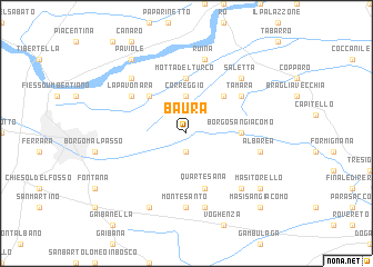
Baura (Italy)Baura is a town in Italy. An overview map of the region around Baura is displayed below.
regional and 3d topo map of Baura, Italy ::
Baura airports ::
The nearest airport is BLQ - Bologna, located 48.7 km south west of Baura.
Other airports nearby include QPA - Padova (61.5 km north), FRL - Forli (78.0 km south), VIC - Vicenza (81.7 km north), VCE - Venice Venezia Tessera (88.3 km north east), Nearby towns ::
Palazzina (1.9km south) //
Correggio (3.7km north) //
Corlo (4.5km north east) //
Boara (4.5km north west) //
Motta del Turco (5.6km north) //
Borgo San Giacomo (3.9km east) //
Quartesana (5.7km south) //
La Pavonara (5.4km north west) //
Tamara (5.4km north east) //
Montesanto (7.4km south) //
Albarea (5.6km east) //
Gualdo (7.5km south) //
Ruina (7.5km north) //
Francolino (6.8km north west) //
Ca Matte (6.8km north east) //
Saletta (6.8km north east) //
Il Borgo (6.8km south east) //
Chiusa (7.9km south) //
Masi Torello (7.7km south east) //
Paviole (8.4km north west) //
Masi San Giacomo (9.1km south east) //
[all distances 'as the bird flies' and approximate]  Places with similar names to Baura, Italy ::
Disclaimer :: Information on this page comes without warranty of any kind |
||
|
Where is Baura? Elevation and coordinates ::
Latitude (lat): 44°51'0"N Longitude (lon): 11°43'0"E
Elevation (approx.): 1m (map arrows pan, magnifying glasses zoom) |
||
|
Visiting Baura? Hotel/Accommodation ::
Book a hotel in Baura Travel Guide ::
Buy a travel guide for Italy rental cars ::
car rental offers GPS waypoint ::
download a GPX waypoint (PoI) of Baura for your GPS receiver
|
||