|
search place name
|
||
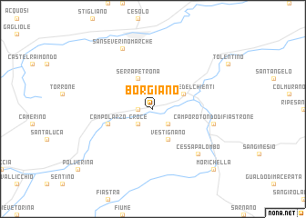
Borgiano (Italy)Borgiano is a town in Italy. An overview map of the region around Borgiano is displayed below.
regional and 3d topo map of Borgiano, Italy ::
Borgiano airports ::
The nearest airport is PEG - Perugia, located 56.2 km west of Borgiano.
Other airports nearby include RMI - Rimini (107.7 km north west), PSR - Pescara (113.2 km south east), FRL - Forli (147.6 km north west), CIA - Rome Ciampino (158.1 km south), Nearby towns ::
Borgianello (1.4km west) //
Caldarola (2.3km south east) //
Croce (2.3km south west) //
Vestignano (3.9km south) //
Belforte del Chienti (3.3km north east) //
Serrapetrona (3.9km north) //
Campolarzo (4.5km south west) //
Camporotondo di Fiastrone (5.7km east) //
Cessapalombo (6.9km south east) //
San Severino Marche (7.9km north) //
Morichella (9.2km south east) //
[all distances 'as the bird flies' and approximate]  Places with similar names to Borgiano, Italy ::
// Bergen (AT)
// Bergen (AT)
// Bergin (AT)
// Brögen (AT)
// Burro John (US)
// Bargen (DE)
// Bargen (DE)
// Bargen (DE)
// Bargen (DE)
// Bauerrögen (DE)
Disclaimer :: Information on this page comes without warranty of any kind |
||
|
Where is Borgiano? Elevation and coordinates ::
Latitude (lat): 43°9'0"N Longitude (lon): 13°12'0"E
Elevation (approx.): 357m (map arrows pan, magnifying glasses zoom) |
||
|
Visiting Borgiano? Hotel/Accommodation ::
Book a hotel in Borgiano Travel Guide ::
Buy a travel guide for Italy rental cars ::
car rental offers GPS waypoint ::
download a GPX waypoint (PoI) of Borgiano for your GPS receiver
|
||