|
search place name
|
||
Borgo Panigale (Italy)Borgo Panigale is a town in Italy. An overview map of the region around Borgo Panigale is displayed below.
regional and 3d topo map of Borgo Panigale, Italy ::

nearby GPS traces from timatio ::
Borgo Panigale airports ::
The nearest airport is BLQ - Bologna, located 2.7 km north east of Borgo Panigale.
Other airports nearby include FRL - Forli (73.4 km south east), FLR - Firenze (78.7 km south), PMF - Parma (84.2 km north west), VRN - Villafranca (102.1 km north), Nearby towns ::
Rigosa (1.3km west) //
Tre Madonne (2.3km south east) //
Lavino di Mezzo (3.2km north west) //
Riale (4.6km south west) //
Calderara di Reno (5.6km north) //
Casalecchio di Reno (5.6km south) //
Santa Viola (4.4km south east) //
Sacerno (6.2km north west) //
Tavernelle dʼEmilia (6.2km north west) //
Madonna dei Prati (5.3km west) //
Casa Donini (7.5km north) //
Ponte Ronca (5.6km west) //
Casa la Luna (7.9km north) //
Bologna (6.5km south east) //
Funchio (7.9km south) //
Palazzo Garagnani (6.5km south west) //
Zola Predosa (6.5km south west) //
Casa delle Curve (8.4km north east) //
Santa Maria (8.4km south west) //
[all distances 'as the bird flies' and approximate] 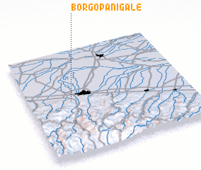 Places with similar names to Borgo Panigale, Italy :: Disclaimer :: Information on this page comes without warranty of any kind |
||
|
Where is Borgo Panigale? Elevation and coordinates ::
Latitude (lat): 44°31'0"N Longitude (lon): 11°16'0"E
Elevation (approx.): 54m (map arrows pan, magnifying glasses zoom) |
||
|
Visiting Borgo Panigale? Hotel/Accommodation ::
Book a hotel in Borgo Panigale Travel Guide ::
Buy a travel guide for Italy rental cars ::
car rental offers GPS waypoint ::
download a GPX waypoint (PoI) of Borgo Panigale for your GPS receiver
|
||