|
search place name
|
||
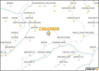
Cadignano (Italy)Cadignano is a town in Italy. An overview map of the region around Cadignano is displayed below.
regional and 3d topo map of Cadignano, Italy ::
Cadignano airports ::
The nearest airport is BLQ - Bologna, located 50.8 km north east of Cadignano.
Other airports nearby include PMF - Parma (64.0 km north west), FLR - Firenze (70.1 km south east), PSA - Pisa (76.7 km south), QPZ - Piacenza (101.8 km north west), Nearby towns ::
Polinago (1.9km north) //
Adelano (2.3km north east) //
Borra (3.9km south) //
Lama Mocogno (4.6km south east) //
Montecenere (4.4km south east) //
Susano (4.4km north west) //
Costrignano (5.4km north west) //
Sassostorno (7.5km south) //
Palagano (5.6km west) //
Lama di Monchio (6.8km north west) //
Monchio (7.7km north west) //
Castellaro (9.1km south east) //
Barigazzo (9.1km south west) //
Cerredolo (9.1km north west) //
[all distances 'as the bird flies' and approximate] 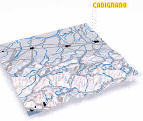 Places with similar names to Cadignano, Italy ::
// Catagnan (PH)
// Cadignano (IT)
// Katukunane (CD)
// Codo Kononi (PY)
// Catignano (IT)
// Codognan (FR)
// Kadougounion (CI)
Disclaimer :: Information on this page comes without warranty of any kind |
||
|
Where is Cadignano? Elevation and coordinates ::
Latitude (lat): 44°20'0"N Longitude (lon): 10°43'0"E
Elevation (approx.): 674m (map arrows pan, magnifying glasses zoom) |
||
|
Visiting Cadignano? Hotel/Accommodation ::
Book a hotel in Cadignano Travel Guide ::
Buy a travel guide for Italy rental cars ::
car rental offers GPS waypoint ::
download a GPX waypoint (PoI) of Cadignano for your GPS receiver
|
||