|
search place name
|
||
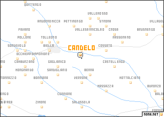
Candelo (Italy)Candelo is a town in Italy. An overview map of the region around Candelo is displayed below.
regional and 3d topo map of Candelo, Italy ::
Candelo airports ::
The nearest airport is MXP - Milano Malpensa, located 48.5 km east of Candelo.
Other airports nearby include TRN - Torino (53.3 km south west), LUG - Lugano (79.8 km north east), LIN - Milan Linate (91.4 km east), SIR - Sion (96.4 km north west), Nearby towns ::
Vigliano Biellese (1.9km north) //
Benna (3.9km south) //
Verrone (5.6km south) //
Valle San Nicolao (5.7km north) //
Gaglianico (4.3km south west) //
Cossato (4.3km north east) //
Sandigliano (5.4km south west) //
Chiavazza (5.4km north west) //
Castellengo (5.5km east) //
Bioglio (7.5km north) //
Biella (5.5km west) //
Pettinengo (7.5km north) //
Tollegno (6.4km north west) //
Crosa (7.6km north east) //
Massazza (8.4km south east) //
Strona (8.4km north east) //
Andorno Micca (9.0km north west) //
[all distances 'as the bird flies' and approximate]  Places with similar names to Candelo, Italy ::
Disclaimer :: Information on this page comes without warranty of any kind |
||
|
Where is Candelo? Elevation and coordinates ::
Latitude (lat): 45°33'0"N Longitude (lon): 8°7'0"E
Elevation (approx.): 288m (map arrows pan, magnifying glasses zoom) |
||
|
Visiting Candelo? Hotel/Accommodation ::
Book a hotel in Candelo Travel Guide ::
Buy a travel guide for Italy rental cars ::
car rental offers GPS waypoint ::
download a GPX waypoint (PoI) of Candelo for your GPS receiver
|
||