|
search place name
|
||
Cantone Giacomello (Italy)Cantone Giacomello is a town in Italy. An overview map of the region around Cantone Giacomello is displayed below.
regional and 3d topo map of Cantone Giacomello, Italy ::

Cantone Giacomello airports ::
The nearest airport is VRN - Villafranca, located 45.7 km north west of Cantone Giacomello.
Other airports nearby include QPA - Padova (57.3 km north east), VIC - Vicenza (58.2 km north), BLQ - Bologna (60.9 km south), PMF - Parma (81.8 km west), Nearby towns ::
Valletta (2.3km south east) //
Bergantino (2.3km south west) //
Casa il Palazzino (2.3km south west) //
Casa Stanghelle (3.2km north east) //
Carbonarola (5.7km south) //
Torricella (6.1km south east) //
Corte le Franzine (6.1km north east) //
San Pietro in Valle (5.4km south east) //
Moglia (7.4km south) //
Contrada Suore (7.5km north) //
Carbonara di Po (6.8km south west) //
Castelmassa (7.9km south) //
Corte Carpania (6.4km north west) //
Pio (7.6km south east) //
Cavo Diversivo (8.4km south west) //
[all distances 'as the bird flies' and approximate] 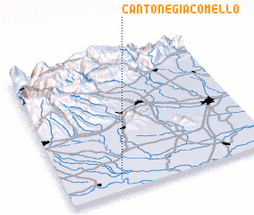 Places with similar names to Cantone Giacomello, Italy :: Disclaimer :: Information on this page comes without warranty of any kind |
||
|
Where is Cantone Giacomello? Elevation and coordinates ::
Latitude (lat): 45°5'0"N Longitude (lon): 11°16'0"E
Elevation (approx.): 5m (map arrows pan, magnifying glasses zoom) |
||
|
Visiting Cantone Giacomello? Hotel/Accommodation ::
Book a hotel in Cantone Giacomello Travel Guide ::
Buy a travel guide for Italy rental cars ::
car rental offers GPS waypoint ::
download a GPX waypoint (PoI) of Cantone Giacomello for your GPS receiver
|
||