|
search place name
|
||
Casa Leonardi (Italy)Casa Leonardi is a town in Italy. An overview map of the region around Casa Leonardi is displayed below.
regional and 3d topo map of Casa Leonardi, Italy ::

Casa Leonardi airports ::
The nearest airport is EBA - Marina Di Campo, located 13.4 km west of Casa Leonardi.
Other airports nearby include GRS - Grosseto (55.1 km east), BIA - Bastia Poretta (79.4 km west), SAY - Siena Ampugnano (87.3 km north east), PSA - Pisa (100.1 km north), Nearby towns ::
Porto Azzurro (1.9km south) //
Casa Tonietti (1.4km east) //
Santa Caterina (3.7km north) //
Rio dellʼElba (3.7km north) //
Casa Buraccio (3.3km south west) //
SantʼAnna (3.3km north west) //
Rio Marina (3.9km north) //
Nisporto (3.9km north) //
Casa Ajali (4.6km south west) //
Capoliveri (4.6km south west) //
Vigneria (4.6km north east) //
Casa Castagno (5.6km north) //
Magazzini (4.5km north west) //
Punta di Rialbano (6.2km north east) //
Casa Carletti (6.2km north east) //
Casa Morcone (6.2km south west) //
Casa Danesi (7.4km north) //
Casa Marchetti (5.4km west) //
Palazzo (7.5km south) //
Cavo (7.5km north) //
[all distances 'as the bird flies' and approximate] 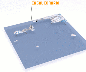 Places with similar names to Casa Leonardi, Italy :: Disclaimer :: Information on this page comes without warranty of any kind |
||
|
Where is Casa Leonardi? Elevation and coordinates ::
Latitude (lat): 42°47'0"N Longitude (lon): 10°24'0"E
Elevation (approx.): 193m (map arrows pan, magnifying glasses zoom) |
||
|
Visiting Casa Leonardi? Hotel/Accommodation ::
Book a hotel in Casa Leonardi Travel Guide ::
Buy a travel guide for Italy rental cars ::
car rental offers GPS waypoint ::
download a GPX waypoint (PoI) of Casa Leonardi for your GPS receiver
|
||