|
search place name
|
||
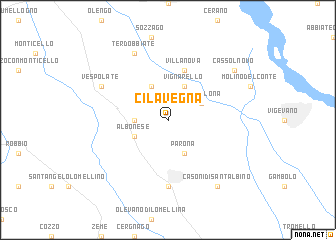
Cilavegna (Italy)Cilavegna is a town in Italy. An overview map of the region around Cilavegna is displayed below.
regional and 3d topo map of Cilavegna, Italy ::
Cilavegna airports ::
The nearest airport is MXP - Milano Malpensa, located 34.9 km north of Cilavegna.
Other airports nearby include LIN - Milan Linate (44.9 km east), LUG - Lugano (77.7 km north), BGY - Bergamo Orio Al Serio (85.6 km north east), TRN - Torino (86.0 km west), Nearby towns ::
Borgo Lavezzaro (2.6km west) //
Tornaco (3.9km north) //
Albonese (3.2km south west) //
Vignarello (3.9km north) //
Gravellona (3.2km north east) //
Parona (3.9km south) //
Villanova (5.7km north) //
Mortara (7.4km south) //
Terdobbiate (7.9km north) //
Vespolate (6.4km north west) //
Casoni di SantʼAlbino (8.4km south east) //
Cassolnovo (7.6km north east) //
[all distances 'as the bird flies' and approximate]  Places with similar names to Cilavegna, Italy ::
// Sillviken (SE)
// Sulviken (SE)
// Selevkino (RU)
// Selivakino (RU)
// Sel'veykino (RU)
// Slavkino (RU)
// Slavkino (RU)
// Slavkino (RU)
// Selvigny (FR)
Disclaimer :: Information on this page comes without warranty of any kind |
||
|
Where is Cilavegna? Elevation and coordinates ::
Latitude (lat): 45°19'0"N Longitude (lon): 8°44'0"E
Elevation (approx.): 112m (map arrows pan, magnifying glasses zoom) |
||
|
Visiting Cilavegna? Hotel/Accommodation ::
Book a hotel in Cilavegna Travel Guide ::
Buy a travel guide for Italy rental cars ::
car rental offers GPS waypoint ::
download a GPX waypoint (PoI) of Cilavegna for your GPS receiver
|
||