|
search place name
|
||
Cimadolmo (Veneto, Italy)Cimadolmo is a town in the Veneto region of Italy. An overview map of the region around Cimadolmo is displayed below.
regional and 3d topo map of Cimadolmo, Italy ::

Cimadolmo airports ::
The nearest airport is TSF - Treviso, located 20.1 km south west of Cimadolmo.
Other airports nearby include VCE - Venice Venezia Tessera (31.3 km south), AVB - Aviano Ab (Pagliano E Gori) (32.8 km north east), QPA - Padova (59.1 km south west), VIC - Vicenza (69.0 km west), Nearby towns ::
San Michele (2.2km north west) //
Buosi (2.5km north west) //
Casa Zonta (4.2km south) //
Salettuol (3.5km south west) //
Borgo del Molino (4.4km south east) //
I Ronchi (5.4km south west) //
Borgo Bianchi (4.5km north east) //
Vazzola (6.0km north) //
Varago (6.7km south west) //
Saletto (7.3km south) //
Breda di Piave (7.6km south) //
Casa Galvagna (6.1km east) //
Ramera (8.1km north) //
Colle di Campana (6.8km north west) //
Negrisia (7.8km south east) //
Borgo di Sopra (9.0km north) //
Vacil (9.3km south west) //
Vascon (8.8km south west) //
Palazzo Del Maino (9.0km north east) //
Capo di Sopra (9.8km north east) //
[all distances 'as the bird flies' and approximate] 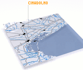 Places with similar names to Cimadolmo, Italy ::
// Xóm Tà Lúa Mới (VN)
Disclaimer :: Information on this page comes without warranty of any kind |
||
|
Where is Cimadolmo? Elevation and coordinates ::
Latitude (lat): 45°47'14"N Longitude (lon): 12°21'38"E
Elevation (approx.): 30m (map arrows pan, magnifying glasses zoom) |
||
|
Visiting Cimadolmo? Hotel/Accommodation ::
Book a hotel in Cimadolmo Travel Guide ::
Buy a travel guide for Italy rental cars ::
car rental offers GPS waypoint ::
download a GPX waypoint (PoI) of Cimadolmo for your GPS receiver
|
||